Maps of okres Karviná

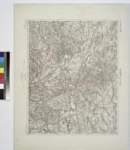
Freistadt Bei Teschen.
from Spezialkarte der osterreichisch-ungarischen Monarchie.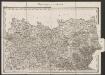
Umgebungen von Teschen
1 : 144000 K.K. Militärisches Geographisches Institut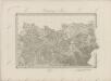
II. vojenské mapování 6
1 : 144000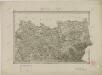
II. vojenské mapování 6
1 : 144000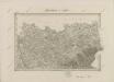
II. vojenské mapování 6
1 : 144000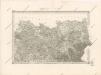
Special - Karte der Markgrafschaft Maehren und des Herzogthums Schlesien

Freistadt bei Teschen
1 : 75000 Cieszyn (Polsko : oblast) Richter, Aug. K. u. k. Militärgeographisches Institut
Fryštát
1 : 75000 Fryštát (Karviná, Česko) Vojenský zeměpisný ústav
Fryštát
1 : 75000 Fryštát (Karviná, Česko) Vojenský zeměpisný ústav
III. vojenské mapování 4061
1 : 75000
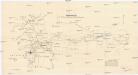
Karte des Gemeindegrenzen

Fryštát
1 : 75000 Fryštát (Karviná, Česko) Vojenský zeměpisný ústav
Fryštát
1 : 75000 Slezsko Vojenský zeměpisný ústav
Podrobná mapa Markrabství moravského a Vévodství slezkého
1 : 100000 Fryštát (Karviná, Česko) Srp, Jan Jos. R. Vilímek
Moravská Ostrava a okolí
1 : 75000 Ostrava (Česko : oblast) Vojenský zeměpisný ústav
Moravská Ostrava a okolí


Uebersichts Karte des Ostrau-Karviner-Steinkohlrevieres
1 : 25000 Karviná (Česko : oblast) Jul. Kittl
III. vojenské mapování 4061/4
1 : 25000
III. vojenské mapování 4061/3
1 : 25000
III. vojenské mapování 4061/1
1 : 25000
Gradkartenblatt
1 : 25000 Havířov-oblast (Česko) Gutwirth, Georg
Gradkartenblatt
1 : 25000 Bohumín-oblast (Česko) Mayer, Johann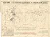
Přehledná mapa Ostravsko-Karviského kamenouhelného revíru

Meßtischblatt 6177 : Pilgramsdorf, 1883
1 : 250000 Pilgramsdorf. - Aufn. 1882. - 1:25000. - [Berlin]: Reichsamt für Landesaufnahme, 1883. - 1 Kt.
Meßtischblatt 6178 : Petersdorf, 1883
1 : 250000 Petersdorf. - 1:25000. - [Berlin]: Reichsamt für Landesaufnahme, 1883. - 1 Kt.
Meßtischblatt 3449 : Jastrzemb, 1884
1 : 250000 Jastrzemb. - Aufn. 1882. - 1:25000. - [Berlin]: Kgl. Preuss. Landesaufnahme, 1884. - 1 Kt.
Meßtischblatt 6076 : Gr. Gorschütz, 1939
1 : 250000 Gr. Gorschütz. - Aufn. 1882, hrsg. 1884, bericht. 1928, letzte Na. - 1:25000. - [Berlin]: Reichsamt für Landesaufnahme, 1939. - 1 Kt.