Maps of Rodkov

Rožinka Opačka - m0819-1-001 - Kaiserpflichtexemplar der Landkarten des stabilen Katasters
1 : 2880
Rožinka Opačka - m0819-1-002 - Kaiserpflichtexemplar der Landkarten des stabilen Katasters
1 : 2880
Blažeowitz - m0111-1-002 - Kaiserpflichtexemplar der Landkarten des stabilen Katasters
1 : 2880
Blažeowitz - m0111-1-001 - Kaiserpflichtexemplar der Landkarten des stabilen Katasters
1 : 2880
Swolla - m3616-1-003 - Kaiserpflichtexemplar der Landkarten des stabilen Katasters
1 : 2880
Swolla - m3616-1-006 - Kaiserpflichtexemplar der Landkarten des stabilen Katasters
1 : 2880
Swolla - m3616-1-005 - Kaiserpflichtexemplar der Landkarten des stabilen Katasters
1 : 2880
Swolla - m3616-1-001 - Kaiserpflichtexemplar der Landkarten des stabilen Katasters
1 : 2880
Swolla - m3616-1-002 - Kaiserpflichtexemplar der Landkarten des stabilen Katasters
1 : 2880
Swolla - m3616-1-004 - Kaiserpflichtexemplar der Landkarten des stabilen Katasters
1 : 2880
Wojetin - m3451-1-001 - Kaiserpflichtexemplar der Landkarten des stabilen Katasters
1 : 2880
Wojetin - m3451-1-002 - Kaiserpflichtexemplar der Landkarten des stabilen Katasters
1 : 2880
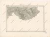
Special - Karte des Koenigreiches Boehmen

Podrobná mapa Království českého
1 : 100000 Bystré (Svitavy, Česko) Srp, Jan Jos. R. Vilímek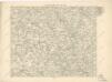
Podrobná místopisná mapa Království Českého

Podrobná mapa Markrabství moravského a Vévodství slezkého
1 : 100000 Bystré (Svitavy, Česko) Srp, Jan Jos. R. Vilímek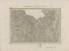
II. vojenské mapování 8
1 : 144000
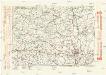
II. vojenské mapování 8
1 : 144000
G. Meseritsch.
from Spezialkarte der osterreichisch-ungarischen Monarchie.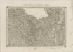
II. vojenské mapování 8
1 : 144000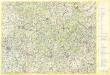
Žďárské vrchy

Žďárské vrchy

Umgebungen von Neustadtl und Brüsau
1 : 144000 K.K. Militärisches Geographisches Institut
Müllerova mapa Čech
1 : 132000
Mapa okolí brněnského
1 : 75000 Brno-oblast (Česko) Rothröckl, L. odbor Klubu čs. turistů
Komunikační mapa země Moravskoslezské
1 : 100000 Brno (Česko : oblast) Morslez. zem. výbor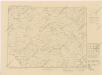
Karte der Gemeindegrenzen


