Maps of Šimonovice

Schimsdorf (Ssimanowice) - c7726-1-001 - Kaiserpflichtexemplar der Landkarten des stabilen Katasters
1 : 2880
Schimsdorf (Ssimanowice) - c7726-1-002 - Kaiserpflichtexemplar der Landkarten des stabilen Katasters
1 : 2880
Schimsdorf (Ssimanowice) - c7726-1-003 - Kaiserpflichtexemplar der Landkarten des stabilen Katasters
1 : 2880
Schimsdorf (Ssimanowice) - c7726-1-004 - Kaiserpflichtexemplar der Landkarten des stabilen Katasters
1 : 2880
Minkendorf - c4691-1-001 - Kaiserpflichtexemplar der Landkarten des stabilen Katasters
1 : 2880
Minkendorf - c4691-1-002 - Kaiserpflichtexemplar der Landkarten des stabilen Katasters
1 : 2880
Raschen (Rassowka) - c6450-1-002 - Kaiserpflichtexemplar der Landkarten des stabilen Katasters
1 : 2880
Raschen (Rassowka) - c6450-1-001 - Kaiserpflichtexemplar der Landkarten des stabilen Katasters
1 : 2880
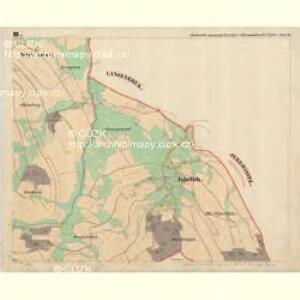
Jabrlich (Jawornik) - c2797-1-001 - Kaiserpflichtexemplar der Landkarten des stabilen Katasters
1 : 2880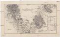
Plan der Gegend von Jeschkenberg über Raschen, Jaberlich, Kohlstadt bis Luxdorff und deren in selber sich befindlichen Verschantzungen
1 : 60000 Javorník (Proseč pod Ještědem, Česko)
Mapa politického okresu Turnovského

III. vojenské mapování 3754/1
1 : 25000
[Kartenblatt]
1 : 25000 Osečná (Česko : oblast) Reichsamt für Landesaufnahme


Mapa politického a školního okresu turnovského

Mapa politického a školního okresu turnovského
1 : 100000 Turnov-oblast (Česko) Učitelská jednota okresu turnovského
Turnov
1 : 75000 Turnov (Česko : oblast) Vojenský zeměpisný ústav
III. vojenské mapování 3754
1 : 75000
Jablonec n. N. a okolí
1 : 75000 Jablonec nad Nisou (Česko : oblast) Vojenský zeměpisný ústav
Turnau
1 : 75000 Mnichovo Hradiště (Česko : oblast) Fitz K. u. k. Militärgeographisches Institut
Turnau
1 : 75000 Mnichovo Hradiště (Česko : oblast) Fitz K. u. k. Militärgeographisches Institut
Turnau
1 : 75000 Turnov (Česko : oblast) K. u. k. Militärgeographisches Institut
Mapka Jizerských hor
1 : 150000 Jizerské hory (Česko a Polsko : oblast) Ed. Grégr
Turnov
1 : 75000 Jablonec nad Nisou (Česko : oblast) Vojenský zeměpisný ústav
Liberec a okolí
1 : 75000 Liberec (Česko : oblast) Vojenský zeměpisný ústav
Karte der Reichenberger Bezirkshauptmannschaft
1 : 70000 Liberec-oblast (Česko) Medau, Karel Vilém Lehrpersonale der Leitmeritzer k.k. Hauptschule
Karte der Reichenberger Bezirkshauptmannschaft
1 : 71000 Liberec-oblast (Česko) Lehrpersonale der Hauptschule
Karte des Bezirkes Reichenberg