Maps of okres Jablonec nad Nisou
Karte der Reichenberger Bezirkshauptmannschaft
1 : 70000 Liberec-oblast (Česko) Medau, Karel Vilém Lehrpersonale der Leitmeritzer k.k. Hauptschule
Karte der Reichenberger Bezirkshauptmannschaft
1 : 71000 Liberec-oblast (Česko) Lehrpersonale der Hauptschule
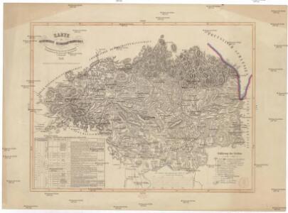
Mapa okresních hejtmanství Libereckého a Jabloneckého

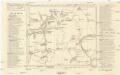
Jablonec n. N. a okolí
1 : 75000 Jablonec nad Nisou (Česko : oblast) Vojenský zeměpisný ústav
Karte der Bezirkshauptmannschaften Reichenberg und Gablonz
1 : 100000 Jablonec nad Nisou-oblast (Česko) Erben, Josef Karl Janský
Liberec a okolí
1 : 75000 Liberec (Česko : oblast) Vojenský zeměpisný ústav
Karte des Bezirkes Reichenberg

Mapka Jizerských hor
1 : 150000 Jizerské hory (Česko a Polsko : oblast) Ed. Grégr
Der politische Bezirk Gablonz


Podrobné mapy zemí Koruny české v měřítku 1:75.000 a mapa vzdáleností všech míst při silnici ležících
1 : 75000 Harrachov (Semily, Česko : oblast) Bělohlav, Josef F. Topič
Podrobné mapy zemí Koruny české v měřítku 1:75.000 a mapa vzdáleností všech míst při silnici ležících - Jablonec - Roketnice - Žel. Brod. Průvodce statisticko-historický po všech místech na těchto mapách uvedených a rejstřík věcný názvů hor, potoků, řek, rybníků atd. Sešit 11. List 78,
1 : 75000


III. vojenské mapování 3654/4
1 : 25000
[Kartenblatt]
1 : 25000 Jablonec nad Nisou (Česko : oblast) Reichsamt für Landesaufnahme
III. vojenské mapování 3754/2
1 : 25000
III. vojenské mapování 3654/4
1 : 25000
[Kartenblatt]
1 : 25000 Bedřichov (Jablonec nad Nisou, Česko : oblast) Reichsamt für Landesaufnahme
Mapa politického okresu Turnovského

Mapa politického okresu Turnovského
Industrie-Wegweiser I/E 1
Držkov (Česko) Weber-Ostwalden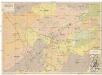
Orientační plán města Liberce s průjezdními ulicemi pro motoristy
1 : 5000 Liberec (Česko) Ježek, Josef AKRČS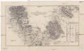
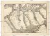
Plan der Gegend von Jeschkenberg über Raschen, Jaberlich, Kohlstadt bis Luxdorff und deren in selber sich befindlichen Verschantzungen
1 : 60000 Javorník (Proseč pod Ještědem, Česko)
Combat de Reichenberg en Bohéme...

[Gradkartenblatt]
1 : 25000 Chrastava-oblast (Liberec, Česko) Vojenský zeměpisný ústav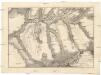
Combat de Reichenberg, en Bohéme, gagné par le prince de Bevern, Lieutenant-général commandant un corps de troupes Prussiennes, sur un autre des impériaux, conduit par le Feldzeugmeister comte de Koenigsegg, le 21. avril, 1757
1 : 69600 Liberec (Česko)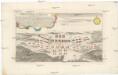
Plan der Bataille bey Reichenberg den 21. April A.o 1757.
Liberec (Česko) Brequin Birckhart, C. in der Raspischen Buchhandlung