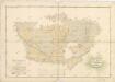
Maps of Svratouch

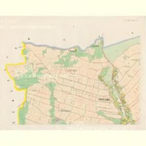
Swratauch - c7672-1-006 - Kaiserpflichtexemplar der Landkarten des stabilen Katasters
1 : 2880
Swratauch - c7672-1-002 - Kaiserpflichtexemplar der Landkarten des stabilen Katasters
1 : 2880
Swratauch - c7672-1-001 - Kaiserpflichtexemplar der Landkarten des stabilen Katasters
1 : 2880
Swratauch - c7672-1-005 - Kaiserpflichtexemplar der Landkarten des stabilen Katasters
1 : 2880
Swratauch - c7672-1-004 - Kaiserpflichtexemplar der Landkarten des stabilen Katasters
1 : 2880
Swratauch - c7672-1-003 - Kaiserpflichtexemplar der Landkarten des stabilen Katasters
1 : 2880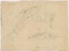
Náčrt mapy pozemků vsí Karlštejn a Svratouch
1 : 3000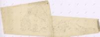
Náčrt mapy pozemků v Chlumětíně a Svratouchu
1 : 3000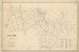
Mapa revíru Čachnov
1 : 10000
Mapa lesů u Čachnova a Rudy včetně železných dolů
1 : 3760
Mapa vsi Pustá Rybná
1 : 3758
Wüst Kamenitz (Pusta Kamenice) - c6285-1-005 - Kaiserpflichtexemplar der Landkarten des stabilen Katasters
1 : 2880
Wüst Kamenitz (Pusta Kamenice) - c6285-1-007 - Kaiserpflichtexemplar der Landkarten des stabilen Katasters
1 : 2880
Wüst Kamenitz (Pusta Kamenice) - c6285-1-006 - Kaiserpflichtexemplar der Landkarten des stabilen Katasters
1 : 2880
Wüst Kamenitz (Pusta Kamenice) - c6285-1-001 - Kaiserpflichtexemplar der Landkarten des stabilen Katasters
1 : 2880
Wüst Kamenitz (Pusta Kamenice) - c6285-1-002 - Kaiserpflichtexemplar der Landkarten des stabilen Katasters
1 : 2880
Wüst Kamenitz (Pusta Kamenice) - c6285-1-004 - Kaiserpflichtexemplar der Landkarten des stabilen Katasters
1 : 2880
Wüst Kamenitz (Pusta Kamenice) - c6285-1-008 - Kaiserpflichtexemplar der Landkarten des stabilen Katasters
1 : 2880
Wüst Kamenitz (Pusta Kamenice) - c6285-1-003 - Kaiserpflichtexemplar der Landkarten des stabilen Katasters
1 : 2880
Swratka - c7671-1-003 - Kaiserpflichtexemplar der Landkarten des stabilen Katasters
1 : 2880
Swratka - c7671-1-004 - Kaiserpflichtexemplar der Landkarten des stabilen Katasters
1 : 2880
Swratka - c7671-1-005 - Kaiserpflichtexemplar der Landkarten des stabilen Katasters
1 : 2880
Swratka - c7671-1-002 - Kaiserpflichtexemplar der Landkarten des stabilen Katasters
1 : 2880
Swratka - c7671-1-001 - Kaiserpflichtexemplar der Landkarten des stabilen Katasters
1 : 2880
Tschachnow (Czachnow) - c0779-1-001 - Kaiserpflichtexemplar der Landkarten des stabilen Katasters
1 : 2880
Tschachnow (Czachnow) - c0779-1-003 - Kaiserpflichtexemplar der Landkarten des stabilen Katasters
1 : 2880
Tschachnow (Czachnow) - c0779-1-002 - Kaiserpflichtexemplar der Landkarten des stabilen Katasters
1 : 2880
Mapa dominikálních vsí Karlštejn a Cikánka
1 : 2880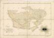
Mapa vsí Čachnov a Ruda
1 : 2918