Maps of Planá

Hangendorf - c7574-2-001 - Kaiserpflichtexemplar der Landkarten des stabilen Katasters
1 : 2880
Hangendorf - c7574-2-003 - Kaiserpflichtexemplar der Landkarten des stabilen Katasters
1 : 2880
Hangendorf - c7574-2-002 - Kaiserpflichtexemplar der Landkarten des stabilen Katasters
1 : 2880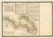
Hospodářská mapa revíru Křínov
1 : 6290
Schliew - c9283-1-002 - Kaiserpflichtexemplar der Landkarten des stabilen Katasters
1 : 2880
Schliew - c9283-1-001 - Kaiserpflichtexemplar der Landkarten des stabilen Katasters
1 : 2880
Schliew - c9283-1-003 - Kaiserpflichtexemplar der Landkarten des stabilen Katasters
1 : 2880
Hospodářská mapa revíru Křínov
1 : 4377
Wieschka (Wischka) - c8641-1-002 - Kaiserpflichtexemplar der Landkarten des stabilen Katasters
1 : 2880
Wieschka (Wischka) - c8641-1-001 - Kaiserpflichtexemplar der Landkarten des stabilen Katasters
1 : 2880
Wieschka (Wischka) - c8641-1-003 - Kaiserpflichtexemplar der Landkarten des stabilen Katasters
1 : 2880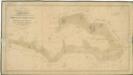
Hospodářská mapa revíru Michalovy Hory
1 : 4350
Gröna - c3650-1-003 - Kaiserpflichtexemplar der Landkarten des stabilen Katasters
1 : 2880
Gröna - c3650-1-002 - Kaiserpflichtexemplar der Landkarten des stabilen Katasters
1 : 2880
Gröna - c3650-1-001 - Kaiserpflichtexemplar der Landkarten des stabilen Katasters
1 : 2880
Brouillon a záměrná mapa revíru Křínov
1 : 5760
Triebl - c8015-1-002 - Kaiserpflichtexemplar der Landkarten des stabilen Katasters
1 : 2880
Triebl - c8015-1-003 - Kaiserpflichtexemplar der Landkarten des stabilen Katasters
1 : 2880
Triebl - c8015-1-001 - Kaiserpflichtexemplar der Landkarten des stabilen Katasters
1 : 2880
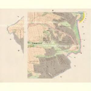
Katastrální mapa obce Pavlovice ZSL-XIII-19 ci
1 : 2880
Kurschin (Kržin) - c3351-1-002 - Kaiserpflichtexemplar der Landkarten des stabilen Katasters
1 : 2880
Kurschin (Kržin) - c3351-1-001 - Kaiserpflichtexemplar der Landkarten des stabilen Katasters
1 : 2880
[Kartenblatt]
1 : 25000 Planá (Tachov, Česko : oblast) Reichsamt für Landesaufnahme

Hospodářská mapa revíru Kočov
1 : 4350
Stříbro a okolí
1 : 75000 Stříbro (Česko : oblast) Vojenský zeměpisný ústav
Tepl und Tuschkau
1 : 75000 Město Touškov (Česko : oblast) Bloschitz, Rudolf K. u. k. Militärgeographisches Institut
Tepl und Tuschkau
1 : 75000 Město Touškov-oblast (Česko) K. u. k. Militärgeographisches Institut
Mariánské Lázně
1 : 75000 Mariánské Lázně (Česko : oblast) Vojenský zeměpisný ústav