Maps of Křimov

Tschoschl - c7396-1-001 - Kaiserpflichtexemplar der Landkarten des stabilen Katasters
1 : 2880
Tschoschl - c7396-1-003 - Kaiserpflichtexemplar der Landkarten des stabilen Katasters
1 : 2880
Tschoschl - c7396-1-002 - Kaiserpflichtexemplar der Landkarten des stabilen Katasters
1 : 2880
Merzdorf - c4549-1-003 - Kaiserpflichtexemplar der Landkarten des stabilen Katasters
1 : 2880
Merzdorf - c4549-1-001 - Kaiserpflichtexemplar der Landkarten des stabilen Katasters
1 : 2880
Merzdorf - c4549-1-002 - Kaiserpflichtexemplar der Landkarten des stabilen Katasters
1 : 2880
Petsch - c0087-1-004 - Kaiserpflichtexemplar der Landkarten des stabilen Katasters
1 : 2880
Petsch - c0087-1-006 - Kaiserpflichtexemplar der Landkarten des stabilen Katasters
1 : 2880
Petsch - c0087-1-003 - Kaiserpflichtexemplar der Landkarten des stabilen Katasters
1 : 2880
Petsch - c0087-1-001 - Kaiserpflichtexemplar der Landkarten des stabilen Katasters
1 : 2880
Petsch - c0087-1-005 - Kaiserpflichtexemplar der Landkarten des stabilen Katasters
1 : 2880
Petsch - c0087-1-002 - Kaiserpflichtexemplar der Landkarten des stabilen Katasters
1 : 2880
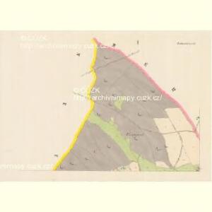
Krima - c3647-1-002 - Kaiserpflichtexemplar der Landkarten des stabilen Katasters
1 : 2880
Krima - c3647-1-001 - Kaiserpflichtexemplar der Landkarten des stabilen Katasters
1 : 2880
Krima - c3647-1-004 - Kaiserpflichtexemplar der Landkarten des stabilen Katasters
1 : 2880
Krima - c3647-1-003 - Kaiserpflichtexemplar der Landkarten des stabilen Katasters
1 : 2880
Dörnthal - c7545-1-002 - Kaiserpflichtexemplar der Landkarten des stabilen Katasters
1 : 2880
Dörnthal - c7545-1-001 - Kaiserpflichtexemplar der Landkarten des stabilen Katasters
1 : 2880
Neudorf - c5216-1-002 - Kaiserpflichtexemplar der Landkarten des stabilen Katasters
1 : 2880
Neudorf - c5216-1-003 - Kaiserpflichtexemplar der Landkarten des stabilen Katasters
1 : 2880
Neudorf - c5216-1-004 - Kaiserpflichtexemplar der Landkarten des stabilen Katasters
1 : 2880
Neudorf - c5216-1-005 - Kaiserpflichtexemplar der Landkarten des stabilen Katasters
1 : 2880
Neudorf - c5216-1-001 - Kaiserpflichtexemplar der Landkarten des stabilen Katasters
1 : 2880
Neudorf - c5216-1-006 - Kaiserpflichtexemplar der Landkarten des stabilen Katasters
1 : 2880

Karte des Bezirkes Sebastiansberg
1 : 37000 Hora Svatého Šebestiána-oblast (Česko) Hollmann, Vict. Jos. Mécsery de Tsóor, Karl Johann Freiherr von Friedrich Selner
Orientierungs-Plan des Strassennetzes der Komotau-Sebastiansberger-Bez. Vertretung mit Inbegriff der eventuell zum Flusbau Kommenden Strassen-Strecken
1 : 75000 Chomutov-oblast (Česko) Loquens, Jos. Bormann, E.
Chomutov a okolí
1 : 75000 Chomutov (Česko : oblast) Vojenský zeměpisný ústav
Sebastiansberg und Sächs. Annaberg
1 : 75000 Hora Svatého Šebestiána-oblast (Česko) K. u. k. Militärgeographisches Institut