Maps of Holedeč

Tronitz - c7382-1-001 - Kaiserpflichtexemplar der Landkarten des stabilen Katasters
1 : 2880
Tronitz - c7382-1-002 - Kaiserpflichtexemplar der Landkarten des stabilen Katasters
1 : 2880
Gross u. Klein Holletitz - c1956-1-004 - Kaiserpflichtexemplar der Landkarten des stabilen Katasters
1 : 2880
Gross u. Klein Holletitz - c1956-1-006 - Kaiserpflichtexemplar der Landkarten des stabilen Katasters
1 : 2880
Gross u. Klein Holletitz - c1956-1-005 - Kaiserpflichtexemplar der Landkarten des stabilen Katasters
1 : 2880
Gross u. Klein Holletitz - c1956-1-002 - Kaiserpflichtexemplar der Landkarten des stabilen Katasters
1 : 2880
Gross u. Klein Holletitz - c1956-1-007 - Kaiserpflichtexemplar der Landkarten des stabilen Katasters
1 : 2880
Gross u. Klein Holletitz - c1956-1-003 - Kaiserpflichtexemplar der Landkarten des stabilen Katasters
1 : 2880
Gross u. Klein Holletitz - c1956-1-001 - Kaiserpflichtexemplar der Landkarten des stabilen Katasters
1 : 2880
Welletitz - c8368-1-003 - Kaiserpflichtexemplar der Landkarten des stabilen Katasters
1 : 2880
Welletitz - c8368-1-001 - Kaiserpflichtexemplar der Landkarten des stabilen Katasters
1 : 2880
Welletitz - c8368-1-002 - Kaiserpflichtexemplar der Landkarten des stabilen Katasters
1 : 2880
Welletitz - c8368-1-004 - Kaiserpflichtexemplar der Landkarten des stabilen Katasters
1 : 2880
Klutschkau - c3184-1-001 - Kaiserpflichtexemplar der Landkarten des stabilen Katasters
1 : 2880
Klutschkau - c3184-1-002 - Kaiserpflichtexemplar der Landkarten des stabilen Katasters
1 : 2880

[Kartenblatt]
1 : 25000 Nechranice (Česko : vodní nádrž) Reichsamt für Landesaufnahme
Chomutov
1 : 75000 Chomutov-oblast (Česko) Vojenský zeměpisný ústav
Chomutov
1 : 75000 Chomutov (Česko : oblast) Vojenský zeměpisný ústav
Saaz und Komotau
1 : 75000 Chomutov (Česko : oblast) Fitz, J. K. u. k. militär-geographisches Institut
Saaz und Komotau
1 : 75000 Chomutov (Česko : oblast) Fitz, J. K. u. k. Militärgeographisches Institut
Saaz und Komotau
1 : 75000 Chomutov (Česko : oblast) K. u. k. Militärgeographisches Institut
Přehledná mapa panství a statků Jana Adolfa Schwarzenberga v severozápadních Čechách 1
1 : 50000
Vilímkovy místopisné mapy zemí Koruny české
1 : 100000 Chomutov (Česko : oblast) Srp, Jan Jos. R. Vilímek
Podrobná mapa Království českého
1 : 100000 Chomutov (Česko : oblast) Srp, Jan Jaroslav Bursík
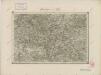
III. vojenské mapování 3851
1 : 75000
Župa lounská
1 : 100000 Louny-oblast (Česko) Nový, Karel Edv. Fastr
Saaz und Komotau.
from Spezialkarte der osterreichisch-ungarischen Monarchie.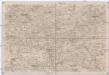
Umgebungen von Lubenz
1 : 750000 Lubenec (Česko : oblast) K. k. militär-geographisches Institut