Maps of Toužim
Umgebungen von Lubenz
1 : 750000 Lubenec (Česko : oblast) K. k. militär-geographisches Institut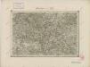
II. vojenské mapování 12
1 : 144000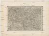
Umgebungen von Lubenz
Lubenec-oblast (Česko) Kiss, Josef K. u. k. Militärgeographisches Institut
Generalkarte der Bezirkshauptmannschaft Podersam
1 : 220000 Podbořany-oblast (Česko) Wagner, Jan Eduard Mareš, František F. Kytka
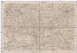
Karlsbad und Luditz.
from Spezialkarte der osterreichisch-ungarischen Monarchie.
Podersam und Rakonitz.
from Spezialkarte der osterreichisch-ungarischen Monarchie.
Podrobná mapa Království českého
1 : 100000 Kralovice (Plzeň-sever, Česko : oblast) Srp, Jan Jaroslav Bursík
III. vojenské mapování 3950
1 : 75000
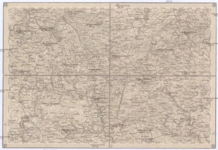
Karlovy Vary
1 : 75000 Karlovy Vary-oblast (Česko) Vojenský zeměpisný ústav
Luditzer Vikariat
Žlutice-oblast (Česko)
Karlsbad und Luditz
1 : 75000 Karlovy Vary (Česko : oblast) Höller, K. K. u. k. Militärgeographisches Institut
Karlsbad und Luditz
1 : 75000 Karlovy Vary (Česko : oblast) K. u. k. Militärgeographisches Institut
Karlovy Vary
1 : 75000 Bochov (Česko : oblast) Vojenský zeměpisný ústav
III. vojenské mapování 3951
1 : 75000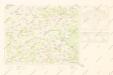
Mapy plánování ČSR

Podersam und Rakonitz
1 : 75000 Podbořany (Česko : oblast) K. u. k. Militärgeographisches Institut
Podersam und Rakonitz
1 : 75000 Podbořany (Česko : oblast) Hertel, A. K. u. k. militär-geographisches Institut
Podersam und Rakonitz
1 : 75000 Podbořany (Česko : oblast) Hertel, A. K. u. k. Militärgeographisches Institut
Podersam und Rakonitz
1 : 75000 Podbořany (Česko : oblast) K. u. k. Militärgeographisches Institut
Rakovník
1 : 75000 Podbořany (Česko : oblast) Vojenský zeměpisný ústav
Rakovník
1 : 75000 Rakovník-oblast (Česko) Vojenský zeměpisný ústav

[Kartenblatt]
1 : 25000 Lubenec (Česko : oblast) Reichsamt für Landesaufnahme
Gradkartenblatt
1 : 25000 Jesenice-oblast (Rakovník, Česko) Bulla, Eduard
Gradkartenblatt
1 : 25000 Žlutice-oblast (Česko) Brück, Josef

III. vojenské mapování 3951/1
1 : 25000

Gradkartenblatt
1 : 25000 Podbořany-oblast (Česko) Bulla, Eduard