Maps of Česká Skalice

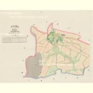
Spitta - c7187-1-002 - Kaiserpflichtexemplar der Landkarten des stabilen Katasters
1 : 2880
Spitta - c7187-1-001 - Kaiserpflichtexemplar der Landkarten des stabilen Katasters
1 : 2880
Skalitz (Skalice) - c0960-1-004 - Kaiserpflichtexemplar der Landkarten des stabilen Katasters
1 : 2880
Skalitz (Skalice) - c0960-1-002 - Kaiserpflichtexemplar der Landkarten des stabilen Katasters
1 : 2880
Skalitz (Skalice) - c0960-1-003 - Kaiserpflichtexemplar der Landkarten des stabilen Katasters
1 : 2880
Skalitz (Skalice) - c0960-1-001 - Kaiserpflichtexemplar der Landkarten des stabilen Katasters
1 : 2880
Scheretz - c7717-1-001 - Kaiserpflichtexemplar der Landkarten des stabilen Katasters
1 : 2880
Scheretz - c7717-1-002 - Kaiserpflichtexemplar der Landkarten des stabilen Katasters
1 : 2880
[Wenzelsberg und Umgebung]
1 : 25000 Václavice (Provodov-Šonov, Česko)
Plan des Gefechtsfeldes von Nachod, Skalitz und Schweinschaedel am 27, 28 u. 29 Juni 1866
1 : 25000 Náchod-oblast (Česko) Baumann Karten-debit königl. preussische Landesaufnahme
Plan zu dem Treffen bey Wysokow (Nachod) bei Skalitz und zum Gefechte bei Schweinschädel
1 : 28800 Náchod (Česko)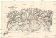
Plan zu dem Treffen bey Wysokow (Nachod), bei Skalitz und zum Gefechte bei Schweinschädel
1 : 28800 Náchod (Česko)
[Kartenblatt]
1 : 25000 Choustníkovo Hradiště (Česko : oblast) Reichsamt für Landesaufnahme
III. vojenské mapování 3856/1
1 : 25000
Gradkartenblatt
1 : 25000 Dvůr Králové nad Labem-oblast (Česko) Böhm, Karl
Gefechtsfeld von Nachod Skalitz und Schweinschädel
1 : 29300 Dolany (Česko : zaniklá obec)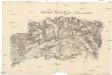
Gefechtsfeld von Nachod Skalitz und Schweinschädel
1 : 29300 Dolany (Česko : zaniklá obec)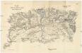
Plan zu denTreffen bei Wysokow (Nachod), bei Skalitz und zum Gefechte bei Schweinschädel 27, 28 und 29 Juni 1866
1 : 28800 Náchod (Česko) Ditfurth, Moritz von des K. u. k. Militärgeographischen Instituts

Náchod
1 : 75000 Náchod-oblast (Česko) Vojenský zeměpisný ústav
Josefov a Náchod
1 : 75000 Náchod (Česko : oblast) Vojenský zeměpisný ústav
Karte des politischen Bezirkes Königinhof

Josefstadt und Nachod
1 : 75000 Dobruška (Česko : oblast) Neumann K. u. k. militär-geographisches Institut
Josefstadt und Nachod
1 : 75000 Dobruška (Česko : oblast) Neumann K. u. k. Militärgeographisches Institut
Josefstadt und Nachod
1 : 75000 Dobruška (Česko : oblast) Neumann K. u. k. Militärgeographisches Institut
Josefstadt und Nachod
1 : 75000 Jaroměř (Česko : oblast) K. u. k. Militärgeographisches Institut
Josefov a Náchod
1 : 75000 Dobruška (Česko : oblast) Vojenský zeměpisný ústav
III. vojenské mapování 3856
1 : 75000
Cís. král. komornj panstwj Hořeňowské a Smiřické s připojeným hraběcým Cerekwickým
1 : 200000 Cerekvice nad Bystřicí (Česko) Hanka