Maps of Dolní Slivno

Klein Sliwno (Maly Sliwno) - c7042-1-002 - Kaiserpflichtexemplar der Landkarten des stabilen Katasters
1 : 2880
Klein Sliwno (Maly Sliwno) - c7042-1-001 - Kaiserpflichtexemplar der Landkarten des stabilen Katasters
1 : 2880
Unter Sliwno - c1387-1-002 - Kaiserpflichtexemplar der Landkarten des stabilen Katasters
1 : 2880
Unter Sliwno - c1387-1-004 - Kaiserpflichtexemplar der Landkarten des stabilen Katasters
1 : 2880
Unter Sliwno - c1387-1-005 - Kaiserpflichtexemplar der Landkarten des stabilen Katasters
1 : 2880
Unter Sliwno - c1387-1-001 - Kaiserpflichtexemplar der Landkarten des stabilen Katasters
1 : 2880
Unter Sliwno - c1387-1-003 - Kaiserpflichtexemplar der Landkarten des stabilen Katasters
1 : 2880
Unter Sliwno - c1387-1-007 - Kaiserpflichtexemplar der Landkarten des stabilen Katasters
1 : 2880
Unter Sliwno - c1387-1-008 - Kaiserpflichtexemplar der Landkarten des stabilen Katasters
1 : 2880
Unter Sliwno - c1387-1-006 - Kaiserpflichtexemplar der Landkarten des stabilen Katasters
1 : 2880
Meczerisch, Kaurzimer K[reis]
1 : 2880 Kouřim (Česko : oblast)
Meczeřisch - c4541-1-003 - Kaiserpflichtexemplar der Landkarten des stabilen Katasters
1 : 2880
Meczeřisch - c4541-1-001 - Kaiserpflichtexemplar der Landkarten des stabilen Katasters
1 : 2880
Meczeřisch - c4541-1-004 - Kaiserpflichtexemplar der Landkarten des stabilen Katasters
1 : 2880
Meczeřisch - c4541-1-002 - Kaiserpflichtexemplar der Landkarten des stabilen Katasters
1 : 2880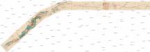
[Železniční trať Kojovice-Dolní Slivno]
Dolní Slivno (Česko)
Sedletz (Sedlec) - c6781-1-002 - Kaiserpflichtexemplar der Landkarten des stabilen Katasters
1 : 2880
Sedletz (Sedlec) - c6781-1-003 - Kaiserpflichtexemplar der Landkarten des stabilen Katasters
1 : 2880
Sedletz (Sedlec) - c6781-1-001 - Kaiserpflichtexemplar der Landkarten des stabilen Katasters
1 : 2880
Gradkartenblatt
1 : 25000 Benátky nad Jizerou-oblast (Česko) Albrecht, Julius
III. vojenské mapování 3853/4
1 : 25000
III. vojenské mapování 3853/4
1 : 25000
III. vojenské mapování 3853/4
1 : 25000

Podrobné mapy zemí Koruny české v měřítku 1:75.000 a mapa vzdáleností všech míst při silnici ležících
1 : 75000 Benátky nad Jizerou (Česko : oblast) Bělohlav, Josef F. Topič
Brandýský vikariát
Brandýs nad Labem-Stará Boleslav-oblast (Česko)
Melnik
1 : 75000 Benátky nad Jizerou (Česko : oblast) Fitz, J. K. u. k. Militärgeographisches Institut
Melnik
1 : 75000 Benátky nad Jizerou (Česko : oblast) Fitz, J. K. u. k. Militärgeographisches Institut
Melnik
1 : 75000 Mělník (Česko : oblast) K. u. k. Militärgeographisches Institut


