Maps of Kropáčova Vrutice

Brandýský vikariát
Brandýs nad Labem-Stará Boleslav-oblast (Česko)
Karte des Brandeiser Bezirkes im Prager Kreise
1 : 70000 Brandýs nad Labem-Stará Boleslav-oblast (Česko) Wagner, Jan Eduard Karl André
Mapa půd v okrese Brandýs n./Lab
1 : 38000 Brandýs nad Labem-Stará Boleslav-oblast (Česko) Spirhanzl, J. Srch, J. reprodukce Voj. zeměpisného ústavu
III. vojenské mapování 3953/2
1 : 25000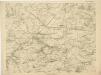
Bez titulu:Sektion 3953 Brandýs nad Labem, Stará Boleslav


III. vojenské mapování 3953/2
1 : 25000
Gradkartenblatt
1 : 25000 Brandýs nad Labem-Stará Boleslav-oblast (Česko) Czechák, Carl
Podrobné mapy zemí Koruny české v měřítku 1:75.000 a mapa vzdáleností všech míst při silnici ležících
1 : 75000 Kostelec nad Labem (Česko : oblast) Bělohlav, Josef Kučera, Karel F. Topič
Podrobné mapy zemí Koruny české v měřítku 1:75.000 a mapa vzdáleností všech míst při silnici ležících - Mělník - Kostelec n. L. Průvodce statisticko-historický po všech místech na těchto mapách uvedených a rejstřík věcný názvů hor, potoků, řek, rybníků atd. Sešit 7. List 54,
1 : 75000
Mapa politického a školního okresu Českobrodského

Mapa politického okresu Mladoboleslavského

Plan der südlichen Gegend von Melnik
1 : 48000 Mělník-oblast (Česko) Schwihlik, Fr.
Projectierte Lager
1 : 15000 Brandýs nad Labem (Česko)
Situations Karte der Excellenz gräflich Nostitz'schen Domaine Pakoměřitz in Böhmen
1 : 20000 Neratovice-oblast (Česko) K.k. Hofbuchdruckerei von Gottlieb Haase Söhne
[Brandeis mit seinen Umgebung]
Brandýs nad Labem-Stará Boleslav-oblast (Česko)
Gradkartenblatt
1 : 25000 Benátky nad Jizerou-oblast (Česko) Albrecht, Julius
III. vojenské mapování 3853/4
1 : 25000
III. vojenské mapování 3853/4
1 : 25000
III. vojenské mapování 3853/4
1 : 25000
Výškopisný plán hlavního města Prahy s okolím


Výškopisný plán hlavního města Prahy s okolím

Meczerisch, Kaurzimer K[reis]
1 : 2880 Kouřim (Česko : oblast)
Situations-Plan des Reservat Jagel Terrains bey Prag gegen Chwala so weil dieses von gegenwärtigen Herrn Kommandirenden auf 6 Jahre gepachtet worden ist
1 : 15000 Trampusek, Franz Le Roy
Mapa politického a školního okresu Karlínského

III. vojenské mapování 3953/1
1 : 25000
III. vojenské mapování 3953/1
1 : 25000


