Maps of Raná

Ranna - c6429-1-002 - Kaiserpflichtexemplar der Landkarten des stabilen Katasters
1 : 2880
Ranna - c6429-1-003 - Kaiserpflichtexemplar der Landkarten des stabilen Katasters
1 : 2880
Ranna - c6429-1-001 - Kaiserpflichtexemplar der Landkarten des stabilen Katasters
1 : 2880
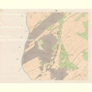
Indikační skica mapy stabilního katastru pro obec Raná
1 : 2880
Mapa vsi Raná a Oflenda
1 : 4055
Indikační skica mapy stabilního katastru pro obec Vojtěchov
1 : 2880
Katastrální mapa pro obec Vojtěchov
1 : 2880
Katastrální mapa pro obec Pokřikov
1 : 2880
Indikační skica mapy stabilního katastru pro obec Pokřikov
1 : 2880
Indikační skica mapy stabilního katastru pro obec Vojtěchov
1 : 2880
Mapa vsi Vojtěchov
1 : 3713
Wogtechow - c8744-1-004 - Kaiserpflichtexemplar der Landkarten des stabilen Katasters
1 : 2880
Wogtechow - c8744-1-005 - Kaiserpflichtexemplar der Landkarten des stabilen Katasters
1 : 2880
Wogtechow - c8744-1-002 - Kaiserpflichtexemplar der Landkarten des stabilen Katasters
1 : 2880
Wogtechow - c8744-1-001 - Kaiserpflichtexemplar der Landkarten des stabilen Katasters
1 : 2880
Wogtechow - c8744-1-003 - Kaiserpflichtexemplar der Landkarten des stabilen Katasters
1 : 2880
Mrakotin (Mrakotjn) - c4868-1-002 - Kaiserpflichtexemplar der Landkarten des stabilen Katasters
1 : 2880
Mrakotin (Mrakotjn) - c4868-1-001 - Kaiserpflichtexemplar der Landkarten des stabilen Katasters
1 : 2880
Mrakotin (Mrakotjn) - c4868-1-003 - Kaiserpflichtexemplar der Landkarten des stabilen Katasters
1 : 2880
Indikační skica mapy stabilního katastru pro obec Vojtěchov
1 : 2880
III. vojenské mapování 4056/3
1 : 25000
Mapa pozemků Horního Holetína a špitálu v Dolním Holetíně
1 : 3758
Mapa vsí Kladno a Oldříš
1 : 3670
Mapa pozemků Horního Holetína a špitálu v Dolním Holetíně
1 : 4109
Mapa vsí Žďárec u Skutče, Malinné a Mrákotín
1 : 3626
Pokrzikow - c5966-1-003 - Kaiserpflichtexemplar der Landkarten des stabilen Katasters
1 : 2880
Pokrzikow - c5966-1-002 - Kaiserpflichtexemplar der Landkarten des stabilen Katasters
1 : 2880
Pokrzikow - c5966-1-001 - Kaiserpflichtexemplar der Landkarten des stabilen Katasters
1 : 2880
Holletin (Holetjn) - c1289-1-003 - Kaiserpflichtexemplar der Landkarten des stabilen Katasters
1 : 2880
Holletin (Holetjn) - c1289-1-001 - Kaiserpflichtexemplar der Landkarten des stabilen Katasters
1 : 2880
Holletin (Holetjn) - c1289-1-004 - Kaiserpflichtexemplar der Landkarten des stabilen Katasters
1 : 2880