Maps of Spořice

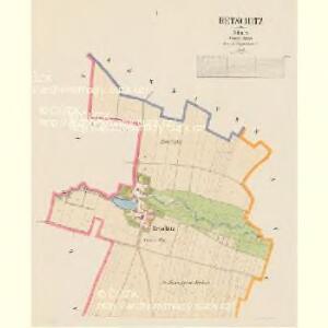
Retschitz - c6306-1-002 - Kaiserpflichtexemplar der Landkarten des stabilen Katasters
1 : 2880
Retschitz - c6306-1-001 - Kaiserpflichtexemplar der Landkarten des stabilen Katasters
1 : 2880
Naschau - c4969-1-001 - Kaiserpflichtexemplar der Landkarten des stabilen Katasters
1 : 2880
Naschau - c4969-1-002 - Kaiserpflichtexemplar der Landkarten des stabilen Katasters
1 : 2880
Kralupp (Kralupy) - c3502-2-004 - Kaiserpflichtexemplar der Landkarten des stabilen Katasters
1 : 2880
Kralupp (Kralupy) - c3502-2-003 - Kaiserpflichtexemplar der Landkarten des stabilen Katasters
1 : 2880
Kralupp (Kralupy) - c3502-2-005 - Kaiserpflichtexemplar der Landkarten des stabilen Katasters
1 : 2880
Kralupp (Kralupy) - c3502-2-002 - Kaiserpflichtexemplar der Landkarten des stabilen Katasters
1 : 2880
Kralupp (Kralupy) - c3502-2-001 - Kaiserpflichtexemplar der Landkarten des stabilen Katasters
1 : 2880
Körbitz - c3544-1-001 - Kaiserpflichtexemplar der Landkarten des stabilen Katasters
1 : 2880
Körbitz - c3544-1-002 - Kaiserpflichtexemplar der Landkarten des stabilen Katasters
1 : 2880
Körbitz - c3544-1-003 - Kaiserpflichtexemplar der Landkarten des stabilen Katasters
1 : 2880
Prösteritz - c6222-1-002 - Kaiserpflichtexemplar der Landkarten des stabilen Katasters
1 : 2880
Prösteritz - c6222-1-001 - Kaiserpflichtexemplar der Landkarten des stabilen Katasters
1 : 2880
Tuschmitz - c8129-1-001 - Kaiserpflichtexemplar der Landkarten des stabilen Katasters
1 : 2880
Tuschmitz - c8129-1-002 - Kaiserpflichtexemplar der Landkarten des stabilen Katasters
1 : 2880

III. vojenské mapování 3851/1
1 : 25000
[Kartenblatt]
1 : 25000 Chomutov (Česko : oblast) Reichsamt für Landesaufnahme
Orientierungs-Plan des Strassennetzes der Komotau-Sebastiansberger-Bez. Vertretung mit Inbegriff der eventuell zum Flusbau Kommenden Strassen-Strecken
1 : 75000 Chomutov-oblast (Česko) Loquens, Jos. Bormann, E.
Chomutov
1 : 75000 Chomutov-oblast (Česko) Vojenský zeměpisný ústav
Chomutov
1 : 75000 Chomutov (Česko : oblast) Vojenský zeměpisný ústav
Chomutov a okolí
1 : 75000 Chomutov (Česko : oblast) Vojenský zeměpisný ústav
Kaaden und Joachimsthal
1 : 75000 Jáchymov (Karlovy Vary, Česko : oblast) Leitner K. u. k. militär-geographisches Institut
Kaaden und Joachimsthal
1 : 75000 Jáchymov (Karlovy Vary, Česko : oblast) Leitner K. u. k. Militärgeographisches Institut
Kaaden und Joachimsthal
1 : 75000 Jáchymov (Karlovy Vary, Česko : oblast) K. u. k. Militärgeographisches Institut
Saaz und Komotau
1 : 75000 Chomutov (Česko : oblast) Fitz, J. K. u. k. militär-geographisches Institut
Saaz und Komotau
1 : 75000 Chomutov (Česko : oblast) Fitz, J. K. u. k. Militärgeographisches Institut
Saaz und Komotau
1 : 75000 Chomutov (Česko : oblast) K. u. k. Militärgeographisches Institut