Maps of Pňov-Předhradí

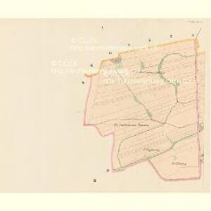
Przedhrad (Předhrad) - c6167-1-002 - Kaiserpflichtexemplar der Landkarten des stabilen Katasters
1 : 2880
Przedhrad (Předhrad) - c6167-1-001 - Kaiserpflichtexemplar der Landkarten des stabilen Katasters
1 : 2880
Pňow - c5852-1-003 - Kaiserpflichtexemplar der Landkarten des stabilen Katasters
1 : 2880
Pňow - c5852-1-004 - Kaiserpflichtexemplar der Landkarten des stabilen Katasters
1 : 2880
Pňow - c5852-1-002 - Kaiserpflichtexemplar der Landkarten des stabilen Katasters
1 : 2880
Pňow - c5852-1-001 - Kaiserpflichtexemplar der Landkarten des stabilen Katasters
1 : 2880
Messtisch-Aufnahme von Juni und Juli 1876 der Elbepartie nächst Weltrub
1 : 8700 Labe (Česko a Německo) Mayr, Josef Fiala, Franz
Wosetschek (Woseček) - c5520-1-002 - Kaiserpflichtexemplar der Landkarten des stabilen Katasters
1 : 2880
Wosetschek (Woseček) - c5520-1-001 - Kaiserpflichtexemplar der Landkarten des stabilen Katasters
1 : 2880
Wosetschek (Woseček) - c5520-1-003 - Kaiserpflichtexemplar der Landkarten des stabilen Katasters
1 : 2880
Bestandeskarte für die Excursion des böhmischen Forstvereines im August 1896 auf der Domaine Poděbrad nach Befund des Wirtschaftjahres 1896
1 : 17280 Poděbrady-oblast (Česko) Voborník, Fr.
Bestandeskarte sammt nächster Umgebung für die Excursion des böhmischen Forstvereines im Juli 1907 auf der Domaine Poděbrad nach Befund des Wirtschaftjahres 1907
Poděbrady-oblast (Česko) Voborník, F. Renard Kartografie Ant. Vítek
Labe u Veltrub

III. vojenské mapování 3954/4
1 : 25000
III. vojenské mapování 3954/4
1 : 25000
Gradkartenblatt
1 : 25000 Kolín-oblast (Česko) Czechák, Carl
Plan der Bataille bey Kollin den 18ten Junius 1757
Kolín (Česko : oblast)
Eisenbahn Karte Wien-Dresden, Ollmütz-Trübau
1 : 72000 Blatt 12 Minarzik, Anselm J. Rauh
Plan der Bataille welche den 18. Junii 1757 von der kayserlich königlich-ungarischen und königlich preussischen Armée in Böhmen ohnweit Planian und Collin bey Chotzemitz geliefert worden.
Kolín-oblast (Česko) Čermak, Jan Grale, Conrad
Nejnovější plán král. hlav. města Prahy a sousedních předměstí
1 : 12000
Kolínský vikariát
Kolín-oblast (Česko)
III. vojenské mapování 3954
1 : 75000
Neu-Kolin
1 : 75000 Kolín (Česko : oblast) Ansion K. u. k. Militärgeographisches Institut
Neu-Kolin
1 : 75000 Kolín (Česko : oblast) K. u. k. Militärgeographisches Institut
Kolín (Kolin)
1 : 75000 Kolín (Česko : oblast) Zeměpisný ústav ministerstva vnitra
Karte des Gemeindegrenzen

Soubor přehledných map pro plánování a statistiku: 3954 – Kolín

Vilímkovy podrobné mapy politických okresů

Politický okres Kolín
1 : 100000 Kolín (Česko) Josef Richard Vilímek