Maps of Nová Ves

Neudorf (Nowa Wes) - c5214-1-004 - Kaiserpflichtexemplar der Landkarten des stabilen Katasters
1 : 2880
Neudorf (Nowa Wes) - c5214-1-002 - Kaiserpflichtexemplar der Landkarten des stabilen Katasters
1 : 2880
Neudorf (Nowa Wes) - c5214-1-005 - Kaiserpflichtexemplar der Landkarten des stabilen Katasters
1 : 2880
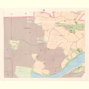
Neudorf (Nowa Wes) - c5214-1-001 - Kaiserpflichtexemplar der Landkarten des stabilen Katasters
1 : 2880
Neudorf (Nowa Wes) - c5214-1-003 - Kaiserpflichtexemplar der Landkarten des stabilen Katasters
1 : 2880
Indikační skica mapy stabilního katastru pro obec Nová Ves III.
1 : 2880
Indikační skica mapy stabilního katastru pro obec Nová Ves VI.
1 : 2880
Indikační skica mapy stabilního katastru pro obec Nová Ves II., IV.
1 : 2880
Indikační skica mapy stabilního katastru pro obec Nová Ves I., V.
1 : 2880
Albrechtitz - c0016-1-001 - Kaiserpflichtexemplar der Landkarten des stabilen Katasters
1 : 2880
Albrechtitz - c0016-1-003 - Kaiserpflichtexemplar der Landkarten des stabilen Katasters
1 : 2880
Albrechtitz - c0016-1-002 - Kaiserpflichtexemplar der Landkarten des stabilen Katasters
1 : 2880
Indikační skica mapy stabilního katastru pro obec Albrechtice nad Orlicí III.
1 : 2880
Indikační skica mapy stabilního katastru pro obec Albrechtice nad Orlicí I.
1 : 2880
Indikační skica mapy stabilního katastru pro obec Vysoké Chvojno I.-XI.
1 : 2880
Mapa revíru Vysoké Chvojno
1 : 800
Indikační skica mapy stabilního katastru pro obec Poběžovice u Holic I.-X.
1 : 2880
Zdiar - c9371-1-006 - Kaiserpflichtexemplar der Landkarten des stabilen Katasters
1 : 2880
Zdiar - c9371-1-003 - Kaiserpflichtexemplar der Landkarten des stabilen Katasters
1 : 2880
Zdiar - c9371-1-002 - Kaiserpflichtexemplar der Landkarten des stabilen Katasters
1 : 2880
Zdiar - c9371-1-004 - Kaiserpflichtexemplar der Landkarten des stabilen Katasters
1 : 2880
Zdiar - c9371-1-001 - Kaiserpflichtexemplar der Landkarten des stabilen Katasters
1 : 2880
Zdiar - c9371-1-005 - Kaiserpflichtexemplar der Landkarten des stabilen Katasters
1 : 2880
Porostní mapa revíru Holice
1 : 10000
Indikační skica mapy stabilního katastru pro obec Vysoké Chvojno I., X.
1 : 2880
Tinischt - c8157-1-004 - Kaiserpflichtexemplar der Landkarten des stabilen Katasters
1 : 2880
Tinischt - c8157-1-003 - Kaiserpflichtexemplar der Landkarten des stabilen Katasters
1 : 2880
Tinischt - c8157-1-002 - Kaiserpflichtexemplar der Landkarten des stabilen Katasters
1 : 2880
Tinischt - c8157-1-001 - Kaiserpflichtexemplar der Landkarten des stabilen Katasters
1 : 2880