Maps of Teplá

Prosau - c4872-1-001 - Kaiserpflichtexemplar der Landkarten des stabilen Katasters
1 : 2880
Prosau - c4872-1-002 - Kaiserpflichtexemplar der Landkarten des stabilen Katasters
1 : 2880
Weserau (Bezwěrow) - c0169-1-003 - Kaiserpflichtexemplar der Landkarten des stabilen Katasters
1 : 2880
Weserau (Bezwěrow) - c0169-1-001 - Kaiserpflichtexemplar der Landkarten des stabilen Katasters
1 : 2880
Weserau (Bezwěrow) - c0169-1-002 - Kaiserpflichtexemplar der Landkarten des stabilen Katasters
1 : 2880
Obergramling - c2071-1-002 - Kaiserpflichtexemplar der Landkarten des stabilen Katasters
1 : 2880
Obergramling - c2071-1-001 - Kaiserpflichtexemplar der Landkarten des stabilen Katasters
1 : 2880
Enkengrün (Jankowice) - c2747-1-003 - Kaiserpflichtexemplar der Landkarten des stabilen Katasters
1 : 2880
Enkengrün (Jankowice) - c2747-1-001 - Kaiserpflichtexemplar der Landkarten des stabilen Katasters
1 : 2880
Enkengrün (Jankowice) - c2747-1-002 - Kaiserpflichtexemplar der Landkarten des stabilen Katasters
1 : 2880
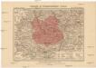
Přehledná mapa panství Planá
1 : 25000

Umgebungskarte von Marienbad
1 : 25000 Mariánské Lázně (Česko : oblast) R. Lechner's k. u. k. Hof.- u. Univ.- Buchhandl. (Wilhelm Müller)
Umgebungskarte von Marienbad
1 : 25000 Mariánské Lázně (Česko : oblast) Franz Gschihay
Rundansicht von dem Basaltberge Podhorn (2634 Wien. Fuss) auf der Herrschaft Tepl bei Marienbad
Mariánské Lázně-oblast (Česko) Frey, Paul
Rundansicht von dem Basaltberge Podhorn (833 Meter) auf der Herrschaft Tepl bei Marienbad
Mariánské Lázně-oblast (Česko) F.A. Götz
Umgebungskarte der Curstadt Marienbad
1 : 60000 Mariánské Lázně-oblast (Česko) E.A. Götz
Umgebungskarte der Kurstadt Marienbad
1 : 50000 Mariánské Lázně-oblast (Česko) E.A. Götz
Teusinger Vikariat
Toužim-oblast (Česko)
Tepl und Tuschkau
1 : 75000 Město Touškov (Česko : oblast) Bloschitz, Rudolf K. u. k. Militärgeographisches Institut
Tepl und Tuschkau
1 : 75000 Město Touškov-oblast (Česko) K. u. k. Militärgeographisches Institut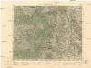
Mariánské Lázně
1 : 75000 Mariánské Lázně (Česko : oblast) Vojenský zeměpisný ústav
Mariánské Lázně
1 : 75000 Mariánské Lázně-oblast (Česko) Vojenský zeměpisný ústav
[Vilímkovy místopisné mapy zemí Koruny české]
1 : 100000 Karlovy Vary (Česko : oblast) Srp, Jan Jos. R. Vilímek
Tepl und Tuschkau.
from Spezialkarte der osterreichisch-ungarischen Monarchie.
Marienbad und Tachau.
from Spezialkarte der osterreichisch-ungarischen Monarchie.
Eger und Falkenau.
from Spezialkarte der osterreichisch-ungarischen Monarchie.
Karlsbad und Luditz.
from Spezialkarte der osterreichisch-ungarischen Monarchie.
Západočeské lázně