Maps of Toužim

[Vilímkovy místopisné mapy zemí Koruny české]
1 : 100000 Karlovy Vary (Česko : oblast) Srp, Jan Jos. R. Vilímek


III. vojenské mapování 3949
1 : 75000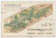
Montangeologische Karte der Braunkohlenreviere von Falkenau, Elbogen u. Karlsbad
1 : 50000 Karlovy Vary (Česko : oblast) Frieser, Antonín Adolf Becker
Montangeologische Karte der Braunkohlenreviere von Falkenau, Elbogen u[nd] Karlsbad
1 : 50000 Karlovy Vary (Česko : oblast) Frieser, Anton Adolf Becker
Umgebungskarte der Kurstadt Marienbad
1 : 50000 Mariánské Lázně-oblast (Česko) E.A. Götz
Rundansicht von dem Basaltberge Podhorn (2634 Wien. Fuss) auf der Herrschaft Tepl bei Marienbad
Mariánské Lázně-oblast (Česko) Frey, Paul
Rundansicht von dem Basaltberge Podhorn (833 Meter) auf der Herrschaft Tepl bei Marienbad
Mariánské Lázně-oblast (Česko) F.A. Götz
Karte des politischen Bezirkes Falkenau
1 : 30000 Sokolov-oblast (Česko) Hoffmann, Josef Franz Wurda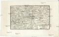
Karlsbad
1 : 220000 Karlovy Vary-oblast (Česko) Streit, Friedrich Wilhelm Müller, Leopold
[Mapový list]
1 : 25000 Lázně Kynžvart-oblast (Česko) Vojenský zeměpisný ústav
Gradkartenblatt
1 : 25000 Toužim-oblast (Česko) Böhm Karl
[Kartenblatt]
1 : 25000 Bezvěrov (Plzeň-sever, Česko : oblast) Reichsamt für Landesaufnahme
III. vojenské mapování 3950/3
1 : 25000
III. vojenské mapování 3949/4
1 : 25000
III. vojenské mapování 3949/4
1 : 25000
[Kartenblatt]
1 : 25000 Bečov nad Teplou (Česko : oblast) Reichsamt für Landesaufnahme
[Kartenblatt]
1 : 25000 Bečov nad Teplou (Česko : oblast) Reichsamt für Landesaufnahme
III. vojenské mapování 3950/3
1 : 25000
Umgebungskarte von Marienbad
1 : 25000 Mariánské Lázně (Česko : oblast) Franz Gschihay
Gradkartenblatt
1 : 25000 Lázně Kynžvart-oblast (Česko) Böhm, Karl
Gradkartenblatt
1 : 25000 Karlovy Vary-oblast (Česko) Böhm, Karl
[Kartenblatt]
1 : 25000 Bochov (Česko : oblast) Reichsamt für Landesaufnahme
III. vojenské mapování 3950/1
1 : 25000
[Kartenblatt]
1 : 25000 Chodov (Karlovy Vary, Česko) Reichsamt für Landesaufnahme
III. vojenské mapování 3949/2
1 : 25000
III. vojenské mapování 3949/2
1 : 25000
Mariánské Lázně
1 : 30000 Mariánské Lázně-oblast (Česko) Frank Tetour, Bohumil Voj. zeměpisný ústav
Königswarth - c3820-1-017 - Kaiserpflichtexemplar der Landkarten des stabilen Katasters
1 : 2880
Königswarth - c3820-1-015 - Kaiserpflichtexemplar der Landkarten des stabilen Katasters
1 : 2880
Königswarth - c3820-1-011 - Kaiserpflichtexemplar der Landkarten des stabilen Katasters
1 : 2880
Königswarth - c3820-1-018 - Kaiserpflichtexemplar der Landkarten des stabilen Katasters
1 : 2880
Königswarth - c3820-1-010 - Kaiserpflichtexemplar der Landkarten des stabilen Katasters
1 : 2880
Königswarth - c3820-1-008 - Kaiserpflichtexemplar der Landkarten des stabilen Katasters
1 : 2880
Königswarth - c3820-1-004 - Kaiserpflichtexemplar der Landkarten des stabilen Katasters
1 : 2880
Königswarth - c3820-1-013 - Kaiserpflichtexemplar der Landkarten des stabilen Katasters
1 : 2880
Königswarth - c3820-1-014 - Kaiserpflichtexemplar der Landkarten des stabilen Katasters
1 : 2880
Königswarth - c3820-1-009 - Kaiserpflichtexemplar der Landkarten des stabilen Katasters
1 : 2880
Königswarth - c3820-1-002 - Kaiserpflichtexemplar der Landkarten des stabilen Katasters
1 : 2880
Königswarth - c3820-1-007 - Kaiserpflichtexemplar der Landkarten des stabilen Katasters
1 : 2880
Königswarth - c3820-1-016 - Kaiserpflichtexemplar der Landkarten des stabilen Katasters
1 : 2880
Königswarth - c3820-1-006 - Kaiserpflichtexemplar der Landkarten des stabilen Katasters
1 : 2880
Königswarth - c3820-1-001 - Kaiserpflichtexemplar der Landkarten des stabilen Katasters
1 : 2880
Königswarth - c3820-1-003 - Kaiserpflichtexemplar der Landkarten des stabilen Katasters
1 : 2880
Königswarth - c3820-1-019 - Kaiserpflichtexemplar der Landkarten des stabilen Katasters
1 : 2880
Königswarth - c3820-1-012 - Kaiserpflichtexemplar der Landkarten des stabilen Katasters
1 : 2880
![[Vilímkovy místopisné mapy zemí Koruny české]](https://images-2.georeferencer.com/images/iiif/435288373142/full/,300/0/native.jpg)

