Maps of Březová

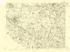
III. vojenské mapování 3949
1 : 75000
Eger und Falkenau
1 : 75000 Cheb (Česko : oblast) Höller, K. K. u. k. militär-geographisches Institut
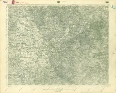
Eger und Falkenau
1 : 75000 Cheb (Česko : oblast) Höller, K. K. u. k. Militärgeographisches Institut
Eger und Falkenau
1 : 75000 Cheb (Česko : oblast) K. u. k. Militärgeographisches Institut
Cheb
1 : 75000 Cheb (Česko : oblast) Vojenský zeměpisný ústav
Cheb
1 : 75000 Cheb-oblast (Česko) Vojenský zeměpisný ústav
Falkenauer Vicariat
Sokolov-oblast (Česko)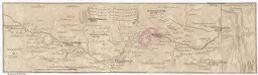
Marsch des k. frantzöischen Corpo, so Duc d'Mallabois com[m]andirt, wie weit selbiges in Böhmen avancirt A. 1742
1 : 247000 Cheb-oblast (Česko)
Karte des politischen Bezirkes Falkenau
1 : 30000 Sokolov-oblast (Česko) Hoffmann, Josef Franz Wurda
Gradkartenblatt
1 : 25000 Loket-oblast (Sokolov, Česko) Böhm, Karl
Karte der Bezirke Falkenau u. Graslitz
1 : 100000 Kraslice-oblast (Česko) Stelzig, Heinrich Heinr. Stelzig
Egerischer Bezirck an Königreich Böhmen nebst den angrändzenden Ascher-Gebieth.
1 : 350000 Mollova mapová sbírka Weigel, Christoph Weigel, Christoph I. - dědici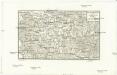
Franzensbrunn und Marienbad
Františkovy Lázně-oblast (Česko) Streit, Friedrich Wilhelm Müller, Leopold
Gradkartenblatt
1 : 25000 Cheb-oblast (Česko) Böhm, Karl
III. vojenské mapování 3949/1
1 : 25000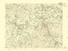
III. vojenské mapování 3949/2
1 : 25000
III. vojenské mapování 3949/2
1 : 25000
[Mapový list]
1 : 25000 Lázně Kynžvart-oblast (Česko) Vojenský zeměpisný ústav
[Mapový list]
1 : 25000 Cheb-oblast (Česko) Vojenský zeměpisný ústav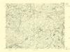
III. vojenské mapování 3949/4
1 : 25000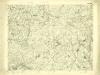
III. vojenské mapování 3949/4
1 : 25000
III. vojenské mapování 3949/1
1 : 25000
[Kartenblatt]
1 : 25000 Cheb (Česko : oblast) Reichsamt für Landesaufnahme
[Kartenblatt]
1 : 25000 Cheb (Česko : oblast) Reichsamt für Landesaufnahme

[Kartenblatt]
1 : 25000 Chodov (Karlovy Vary, Česko) Reichsamt für Landesaufnahme
[Kartenblatt]
1 : 25000 Bečov nad Teplou (Česko : oblast) Reichsamt für Landesaufnahme
[Kartenblatt]
1 : 25000 Bečov nad Teplou (Česko : oblast) Reichsamt für Landesaufnahme
Gradkartenblatt
1 : 25000 Lázně Kynžvart-oblast (Česko) Böhm, Karl