Maps of Jenišovice

Mrawin - c4871-1-001 - Kaiserpflichtexemplar der Landkarten des stabilen Katasters
1 : 2880
Mrawin - c4871-1-003 - Kaiserpflichtexemplar der Landkarten des stabilen Katasters
1 : 2880
Mrawin - c4871-1-002 - Kaiserpflichtexemplar der Landkarten des stabilen Katasters
1 : 2880
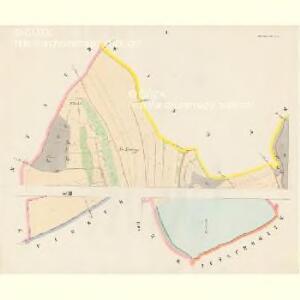
Indikační skica mapy stabilního katastru pro obec Mravín s osadou Popovec
1 : 2880
Indikační skica mapy stabilního katastru pro obec Štěnec I
1 : 2880
Indikační skica mapy stabilního katastru pro obec Mravín s osadou Popovec
1 : 2880
Stienitz (Stěnice) - c7768-1-001 - Kaiserpflichtexemplar der Landkarten des stabilen Katasters
1 : 2880
Stienitz (Stěnice) - c7768-1-002 - Kaiserpflichtexemplar der Landkarten des stabilen Katasters
1 : 2880
Indikační skica mapy stabilního katastru pro obec Mravín s osadou Popovec
1 : 2880
Indikační skica mapy stabilního katastru pro obec Mravín s osadou Popovec
1 : 2880
Indikační skica mapy stabilního katastru pro obec Mravín s osadou Popovec
1 : 2880
Indikační skica mapy stabilního katastru pro obec Mravín s osadou Popovec
1 : 2880
Katastrální mapa pro obec Štěnec
1 : 2880
Indikační skica mapy stabilního katastru pro obec Štěnec ad I
1 : 2880
Mapa propachtovaného dvora Popovec
1 : 1500
Indikační skica mapy stabilního katastru pro obec Štěnec II; IV
1 : 2880
Indikační skica mapy stabilního katastru pro obec Mravín s osadou Popovec
1 : 2880
Indikační skica mapy stabilního katastru pro obec Vinary
1 : 2880
Winnař (Winař) - c8590-1-003 - Kaiserpflichtexemplar der Landkarten des stabilen Katasters
1 : 2880
Winnař (Winař) - c8590-1-001 - Kaiserpflichtexemplar der Landkarten des stabilen Katasters
1 : 2880
Winnař (Winař) - c8590-1-002 - Kaiserpflichtexemplar der Landkarten des stabilen Katasters
1 : 2880
Katastrální mapa pro obec Sedlec
1 : 2880
Katastrální mapa pro obec Pěšice
1 : 2880
Katastrální mapa pro obec Štěnec
1 : 2880
Indikační skica mapy stabilního katastru pro obec Sedlec III
1 : 2880
Katastrální mapa pro obec Vinary
1 : 2880
Katastrální mapa pro obec Sedlec
1 : 2880
Mapa polesí Luže
1 : 10000
Indikační skica mapy stabilního katastru pro obec Rybitví III.
1 : 2880
Sedletz (Sedlec) - c6787-1-002 - Kaiserpflichtexemplar der Landkarten des stabilen Katasters
1 : 2880
Sedletz (Sedlec) - c6787-1-001 - Kaiserpflichtexemplar der Landkarten des stabilen Katasters
1 : 2880