Maps of Krupka

Müglitz - c4804-1-001 - Kaiserpflichtexemplar der Landkarten des stabilen Katasters
1 : 2880
Ebersdorf - c1730-1-005 - Kaiserpflichtexemplar der Landkarten des stabilen Katasters
1 : 2880
Ebersdorf - c1730-1-001 - Kaiserpflichtexemplar der Landkarten des stabilen Katasters
1 : 2880
Ebersdorf - c1730-1-007 - Kaiserpflichtexemplar der Landkarten des stabilen Katasters
1 : 2880
Ebersdorf - c1730-1-004 - Kaiserpflichtexemplar der Landkarten des stabilen Katasters
1 : 2880
Ebersdorf - c1730-1-002 - Kaiserpflichtexemplar der Landkarten des stabilen Katasters
1 : 2880
Ebersdorf - c1730-1-003 - Kaiserpflichtexemplar der Landkarten des stabilen Katasters
1 : 2880
Ebersdorf - c1730-1-006 - Kaiserpflichtexemplar der Landkarten des stabilen Katasters
1 : 2880
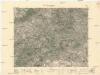
Meßtischblatt 5249 : Peterswald, 1943
1 : 250000 Peterswald. - Aufn. 1932, hrsg. 1934, letzte Nachtr. Sachsen 1937, Sudetenland 1939. - 1:25000. - Leipzig, 1943. - 1 Kt.
Meßtischblatt 120 : Fürstenwalde, 1935
1 : 250000 Fürstenwalde. - Umdr.-Ausg., aufgen. 1932, hrsg. 1934. - 1:25000. - Leipzig, 1935. - 1 Kt.
Meßtischblatt 120 : Fürstenwalde, 1921
1 : 250000 Fürstenwalde. - Aufgen. 1898, revid. 1902, bericht. 1921. - 1:25000. - Leipzig, 1921. - 1 Kt.
Meßtischblatt 120 : Fürstenwalde, 1911
1 : 250000 Fürstenwalde. - Aufgen. 1898, revid. 1902, hrsg. 1911. - 1:25000. - Leipzig, 1911. - 1 Kt.
Kulm 29. August 1813
1 : 300000 Chlumec (Aussig) Napoleonische Kriege , Schlacht
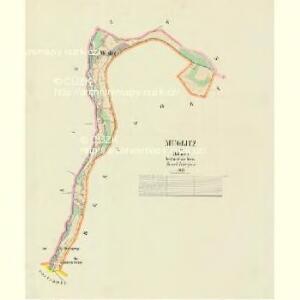
III. vojenské mapování 3752/1
1 : 25000
III. vojenské mapování 3752/1
1 : 25000
III. vojenské mapování 3752/1
1 : 25000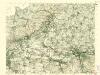
III. vojenské mapování 3752/1
1 : 25000
III. vojenské mapování 3752/1
1 : 25000
[Kartenblatt]
1 : 25000 Krupka (Česko : oblast) Reichsamt für Landesaufnahme

Nollendorf-Kulm 30. August 1813
1 : 300000 Nakléřov Napoleonische Kriege , Schlacht
Die Schlacht bei Kulm am 29. u. 30. August 1813
Chlumec (Ústí nad Labem, Česko) Loquens, Jos. Bormann, E.
Schlacht bei Kulm am 29ten und 30ten August 1813
Vogel von Falckenstein, Eduard; Brose, Karl Heinrich; Prêtre, Jean Gabriel Pretre
[Umgebung von Teplitz]
Krupka-oblast (Česko) Kreibich, František Jakub Jindřich

Teplitz, Bilin, Seidschitz und Sedlitz
1 : 220000 Bílina-oblast (Česko) Streit, Friedrich Wilhelm Müller, Leopold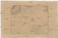
[Bitva u Chlumce a Přestanova]
Chlumec (Ústí nad Labem, Česko) Langweil, Antonín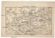
Umgegend von Teplitz
Teplice-oblast (Česko) Jirasek, Johann Goldschmidt, Albert v. Albert Goldschmidt
Touristen-Karte des Aussiger Mittel- und Erzgebirgs-Vereines
1 : 75000 Krušné hory (Česko a Německo) Kroitzsch, Carl Mittel- und Erzgebirgesverein
Litoměřice
1 : 75000 Litoměřice-oblast (Česko) Vojenský zeměpisný ústav