Maps of Krupka
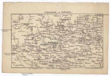
Umgegend von Teplitz
Teplice-oblast (Česko) Jirasek, Johann Goldschmidt, Albert v. Albert Goldschmidt
Uibersichtskarte der Aussig Teplitzer Eisenbahn und der in dieselbe einmündenden Zweigbahnen

Herrschaft Toeplitz im Leutmeritzer Creisse des Koenigreichs Böhmen
1 : 230000 Teplice-oblast (Česko)
[Umgebung von Teplitz]
Krupka-oblast (Česko) Kreibich, František Jakub Jindřich
Teplitz mit seinen Umgebungen
1 : 28800 Teplice-oblast (Česko) Stein, Carl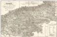
Teplitz mit seinen Umgebungen
1 : 28800 Teplice-oblast (Česko) Stein, Carl
Die Herschaft Toeplitz im Lautmeritzer Creisse des Königreichs Boehmen
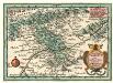
Herrschafft Toeplitz im Leutmeritzer Creisse des Koenigreichs in Böhmen
1 : 233300 Mollova mapová sbírka Weigel, Christoph Weigel, Christoph I.

Teplitz, Bilin, Seidschitz und Sedlitz
1 : 220000 Bílina-oblast (Česko) Streit, Friedrich Wilhelm Müller, Leopold
Teplitz mit seinen Umgebungen
1 : 28800 Teplice-oblast (Česko) Stein, Carl
Pohlig's Karte von Teplitz und dessen Umgebung
Teplice-oblast (Česko) J.W. Pohlig
Schlacht bei Kulm am 29ten und 30ten August 1813
Vogel von Falckenstein, Eduard; Brose, Karl Heinrich; Prêtre, Jean Gabriel Pretre
Die Herschaft Toeplitz im Leutmeritzer Creisse des Königreichs Boehmen
1 : 80000 Mollova mapová sbírka Zürner, Adam Friedrich Schenk, Peter II
[Kartenblatt]
1 : 25000 Krupka (Česko : oblast) Reichsamt für Landesaufnahme
Nollendorf-Kulm 30. August 1813
1 : 300000 Nakléřov Napoleonische Kriege , Schlacht
Teplitz
Geologischer Atlas zur Naturgeschichte der Erde Leonhard, Carl Cäsar von E. Schweizerbart'sche Verlagsbuchhandlung
Die Schlacht bei Kulm am 29. u. 30. August 1813
Chlumec (Ústí nad Labem, Česko) Loquens, Jos. Bormann, E.
III. vojenské mapování 3752/1
1 : 25000
III. vojenské mapování 3752/1
1 : 25000
Karte des politischen Bezirkes Aussig

III. vojenské mapování 3752/1
1 : 25000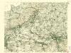
III. vojenské mapování 3752/1
1 : 25000
III. vojenské mapování 3752/1
1 : 25000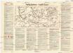
Teplitz-Schönau
Teplice (Česko : oblast) Weber-Ostwalden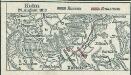
Kulm 29. August 1813
1 : 300000 Chlumec (Aussig) Napoleonische Kriege , Schlacht
[Kartenblatt]
1 : 25000 Dubí (Teplice, Česko : oblast) Reichsamt für Landesaufnahme
III. vojenské mapování 3751/2
1 : 25000
III. vojenské mapování 3751/2
1 : 25000