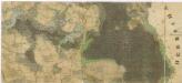
Maps of Mladošovice

Mladoschowitz - c4743-1-002 - Kaiserpflichtexemplar der Landkarten des stabilen Katasters
1 : 2880
Mladoschowitz - c4743-1-001 - Kaiserpflichtexemplar der Landkarten des stabilen Katasters
1 : 2880
Mladoschowitz - c4743-1-003 - Kaiserpflichtexemplar der Landkarten des stabilen Katasters
1 : 2880
Mladoschowitz - c4743-1-004 - Kaiserpflichtexemplar der Landkarten des stabilen Katasters
1 : 2880
Hospodářská karta polesí Domanín 1
1 : 5760
Plán rožšíření choru v mladošovickém kostele 1
Hospodářská mapa polesí Domanín 1
1 : 5760
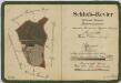
Plán budov mladošovické fary 1
1 : 100
Plán mladošovického kostela 1
1 : 100
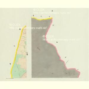
Petrowitz - c5739-1-003 - Kaiserpflichtexemplar der Landkarten des stabilen Katasters
1 : 2880
Petrowitz - c5739-1-002 - Kaiserpflichtexemplar der Landkarten des stabilen Katasters
1 : 2880
Petrowitz - c5739-1-005 - Kaiserpflichtexemplar der Landkarten des stabilen Katasters
1 : 2880
Petrowitz - c5739-1-001 - Kaiserpflichtexemplar der Landkarten des stabilen Katasters
1 : 2880
Petrowitz - c5739-1-004 - Kaiserpflichtexemplar der Landkarten des stabilen Katasters
1 : 2880
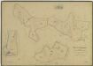
Porostní mapa polesí Zámecké, lesní úsek Domanín 1
Porostní mapa polesí Zámecké, lesní úsek Domanín 1

Hospodářská karta polesí Domanín 1
1 : 5760
Brouillon hospodářská mapa polesí Jílovice 1

Porostní mapa polesí Jílovice 1

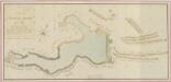
Situační plán erární silnice od dvora Kuna do Ledenic 1
Administrativní mapa třeboňského panství se statky Bzí,Lomnice, Borovany,Hamr a Val 1

Porostní obrysová mapa polesí Domanín 1
1 : 15000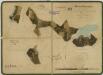
Porostní mapa polesí Domanín 1
1 : 15000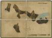
Porostní mapa polesí Domanín 1
1 : 15000
Porostní mapa polesí Domanín 1
1 : 15000
Porostní mapa polesí Domanín 1
1 : 15000
Generální mapa panství Třeboň a inkorporovaných statků Bzí, Lomnice, Borovany, Třeboň, Hamr a Val 1

Cep o. Jindřichův Hradec 1
1 : 2880
Generální mapa panství Třeboň a inkorporovaných statků Bzí, Lomnice, Borovany, Třeboň, Hamr a Val 1