Maps of Skuteč

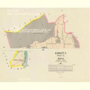
Lhotta - c3946-1-002 - Kaiserpflichtexemplar der Landkarten des stabilen Katasters
1 : 2880
Lhotta - c3946-1-001 - Kaiserpflichtexemplar der Landkarten des stabilen Katasters
1 : 2880
Mapa dominikálních pozemků v Hlubočicích, Dolech, Rabouni, Hněvěticích, Borku, Chlumu, Lhotě u Skutče a Štěpánově
1 : 3448
Indikační skica mapy stabilního katastru pro obec Rychmburk a osady Lažany, Lešany a Dolívka
1 : 2880
Katastrální mapa pro obec Štěpánov a osadu Zbožnov
1 : 2880
Katastrální mapa pro obec Rychmburk
1 : 2880
Mapa vrchnostenského dvora v Bělé a vsí Štěpánov a Zbožnov
1 : 3626
Mapa polesí Košumberk
1 : 10000
Doll (Dol) - c1421-1-001 - Kaiserpflichtexemplar der Landkarten des stabilen Katasters
1 : 2880
Doll (Dol) - c1421-1-005 - Kaiserpflichtexemplar der Landkarten des stabilen Katasters
1 : 2880
Doll (Dol) - c1421-1-002 - Kaiserpflichtexemplar der Landkarten des stabilen Katasters
1 : 2880
Doll (Dol) - c1421-1-006 - Kaiserpflichtexemplar der Landkarten des stabilen Katasters
1 : 2880
Doll (Dol) - c1421-1-004 - Kaiserpflichtexemplar der Landkarten des stabilen Katasters
1 : 2880
Doll (Dol) - c1421-1-003 - Kaiserpflichtexemplar der Landkarten des stabilen Katasters
1 : 2880
Mapa osad Dolany, Chlum, Hlubočice, Rvasice, Brdo, Zhoř a Hluboká
1 : 4164
Porostní mapa polesí Ochoz
1 : 10000
Mapa cest a silnic polesí Košumberk
1 : 10000
Mapa košumberského revíru
1 : 3650
Stěpanow - c7776-1-003 - Kaiserpflichtexemplar der Landkarten des stabilen Katasters
1 : 2880
Stěpanow - c7776-1-004 - Kaiserpflichtexemplar der Landkarten des stabilen Katasters
1 : 2880
Stěpanow - c7776-1-002 - Kaiserpflichtexemplar der Landkarten des stabilen Katasters
1 : 2880
Stěpanow - c7776-1-001 - Kaiserpflichtexemplar der Landkarten des stabilen Katasters
1 : 2880
Hniewietitz (Hněwětic) - c1907-1-001 - Kaiserpflichtexemplar der Landkarten des stabilen Katasters
1 : 2880
Hniewietitz (Hněwětic) - c1907-1-003 - Kaiserpflichtexemplar der Landkarten des stabilen Katasters
1 : 2880
Hniewietitz (Hněwětic) - c1907-1-002 - Kaiserpflichtexemplar der Landkarten des stabilen Katasters
1 : 2880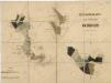
Porostní mapa polesí Ochoz
1 : 10000
Katastrální mapa pro obec Zdislav
1 : 2880
Indikační skica mapy stabilního katastru pro obec Zdislav
1 : 2880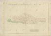
Mapa pozemků dvora v Dolech
1 : 3448