Maps of okres Domažlice

Dingkowitz (Tynkowice) - c2833-1-002 - Kaiserpflichtexemplar der Landkarten des stabilen Katasters
1 : 2880
Dingkowitz (Tynkowice) - c2833-1-001 - Kaiserpflichtexemplar der Landkarten des stabilen Katasters
1 : 2880
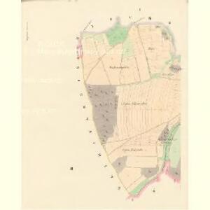
Trzebnitz (Trzebnice) - c8035-1-004 - Kaiserpflichtexemplar der Landkarten des stabilen Katasters
1 : 2880
Trzebnitz (Trzebnice) - c8035-1-001 - Kaiserpflichtexemplar der Landkarten des stabilen Katasters
1 : 2880
Trzebnitz (Trzebnice) - c8035-1-003 - Kaiserpflichtexemplar der Landkarten des stabilen Katasters
1 : 2880
Trzebnitz (Trzebnice) - c8035-1-002 - Kaiserpflichtexemplar der Landkarten des stabilen Katasters
1 : 2880
Niemtschitz (Němčice) - c5119-1-002 - Kaiserpflichtexemplar der Landkarten des stabilen Katasters
1 : 2880
Niemtschitz (Němčice) - c5119-1-001 - Kaiserpflichtexemplar der Landkarten des stabilen Katasters
1 : 2880
Murchowa (Mrchogedy) - c4873-1-001 - Kaiserpflichtexemplar der Landkarten des stabilen Katasters
1 : 2880
Murchowa (Mrchogedy) - c4873-1-002 - Kaiserpflichtexemplar der Landkarten des stabilen Katasters
1 : 2880

Podrobné mapy zemí Koruny české v měřítku 1:75.000 a mapy vzdáleností všech míst při silnici ležících
1 : 75000 Domažlice (Česko : oblast) Bělohlav, Josef F. Topič
Chodsko
1 : 100000 Chodsko (Česko) Klub českých turistů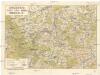
Chodsko
1 : 100000 Chodsko (Česko) Klub českých turistů
Domažlice a okolí
1 : 75000 Domažlice (Česko : oblast) Vojenský zeměpisný ústav
Hospodářská mapa revíru Podzámčí
1 : 5835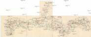
Böhmerwald-Verbindungsbahn
1 : 75000 Domažlice-Planá u Mariánských Lázní (Česko : železniční trať) Technisches Bureau Ing. Max Picha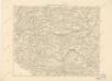
Podrobná místopisná mapa Království Českého

Podrobná mapa Království českého
1 : 100000 Domažlice (Česko : oblast) Srp, Jan Jaroslav Bursík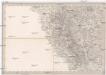
Umgebungen von Klentsch
1 : 750000 Klenčí pod Čerchovem (Česko : oblast) Kiss, Josef K. k. militär-geographisches Institut
II. vojenské mapování 23
1 : 144000
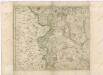
Das Tauser Grenzgebiet
1 : 200000 Chodsko (Česko)
Bischofteinitz und Nurschan.
from Spezialkarte der osterreichisch-ungarischen Monarchie.
Taus und Klattau.
from Spezialkarte der osterreichisch-ungarischen Monarchie.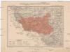
Generální mapa okresního hejtmanství Domažlického
1 : 220000 Domažlice-oblast (Česko) Wagner, Jan Eduard F. Kytka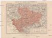
Generální mapa okresního hejtmanství Klatovského
1 : 220000 Klatovy-oblast (Česko) Wagner, Jan Eduard F. Kytka
Generalkarte der Bezirkshauptmannschaft Mies
1 : 220000 Stříbro-oblast (Česko) Wagner, Jan Eduard F. Kytka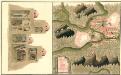
Plan Deren Bergwerg Von Zin Bei Stirn Und Drosau An Tepla Flus
Mollova mapová sbírka Geyer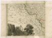
Müllerova mapa Čech
1 : 132000