Maps of Hluboká

Hluboka - c1892-1-002 - Kaiserpflichtexemplar der Landkarten des stabilen Katasters
1 : 2880
Hluboka - c1892-1-001 - Kaiserpflichtexemplar der Landkarten des stabilen Katasters
1 : 2880
Hniewietitz (Hněwětic) - c1907-1-001 - Kaiserpflichtexemplar der Landkarten des stabilen Katasters
1 : 2880
Hniewietitz (Hněwětic) - c1907-1-003 - Kaiserpflichtexemplar der Landkarten des stabilen Katasters
1 : 2880
Hniewietitz (Hněwětic) - c1907-1-002 - Kaiserpflichtexemplar der Landkarten des stabilen Katasters
1 : 2880
Peraletz (Peralec) - c5692-1-001 - Kaiserpflichtexemplar der Landkarten des stabilen Katasters
1 : 2880
Peraletz (Peralec) - c5692-1-003 - Kaiserpflichtexemplar der Landkarten des stabilen Katasters
1 : 2880
Peraletz (Peralec) - c5692-1-002 - Kaiserpflichtexemplar der Landkarten des stabilen Katasters
1 : 2880
Strziterz (Střiteř) - c7482-1-002 - Kaiserpflichtexemplar der Landkarten des stabilen Katasters
1 : 2880
Strziterz (Střiteř) - c7482-1-001 - Kaiserpflichtexemplar der Landkarten des stabilen Katasters
1 : 2880
Indikační skica mapy stabilního katastru pro obec Perálec a osadu Kutřín
1 : 2880
Porostní mapa polesí Ochoz
1 : 10000
Mapa osad Dolany, Chlum, Hlubočice, Rvasice, Brdo, Zhoř a Hluboká
1 : 4164
Doll (Dol) - c1421-1-001 - Kaiserpflichtexemplar der Landkarten des stabilen Katasters
1 : 2880
Doll (Dol) - c1421-1-005 - Kaiserpflichtexemplar der Landkarten des stabilen Katasters
1 : 2880
Doll (Dol) - c1421-1-002 - Kaiserpflichtexemplar der Landkarten des stabilen Katasters
1 : 2880
Doll (Dol) - c1421-1-006 - Kaiserpflichtexemplar der Landkarten des stabilen Katasters
1 : 2880
Doll (Dol) - c1421-1-004 - Kaiserpflichtexemplar der Landkarten des stabilen Katasters
1 : 2880
Doll (Dol) - c1421-1-003 - Kaiserpflichtexemplar der Landkarten des stabilen Katasters
1 : 2880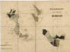
Porostní mapa polesí Ochoz
1 : 10000
Mapa rychmburské stráně
1 : 3000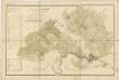
Mapa vrchnostenského dvora Rychmburk a k němu náležejícím pozemkům
1 : 3448
Indikační skica mapy stabilního katastru pro obec Perálec a osadu Kutřín
1 : 2880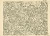
III. vojenské mapování 4056/3
1 : 25000


Mapa dominikální osady Pláňavy
1 : 2880
Vys. Mýto
1 : 75000 Vysoké Mýto (Česko : oblast) Vojenský zeměpisný ústav
Hohenmauth und Leitomischl
1 : 75000 Litomyšl (Česko : oblast) Storch K. u. k. Militärgeographisches Institut


