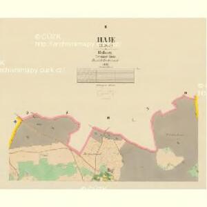
Maps of Háje

Haje (Hage) - c1752-1-002 - Kaiserpflichtexemplar der Landkarten des stabilen Katasters
1 : 2880
Haje (Hage) - c1752-1-001 - Kaiserpflichtexemplar der Landkarten des stabilen Katasters
1 : 2880
Haje (Hage) - c1752-1-003 - Kaiserpflichtexemplar der Landkarten des stabilen Katasters
1 : 2880
Konietop (Konětop) - c3315-1-002 - Kaiserpflichtexemplar der Landkarten des stabilen Katasters
1 : 2880
Konietop (Konětop) - c3315-1-004 - Kaiserpflichtexemplar der Landkarten des stabilen Katasters
1 : 2880
Konietop (Konětop) - c3315-1-003 - Kaiserpflichtexemplar der Landkarten des stabilen Katasters
1 : 2880
Konietop (Konětop) - c3315-1-001 - Kaiserpflichtexemplar der Landkarten des stabilen Katasters
1 : 2880
Bittis - c0727-1-001 - Kaiserpflichtexemplar der Landkarten des stabilen Katasters
1 : 2880
Montan geologische Karte des Bergbau-terrains Přibram

Plan [sic] král[ovského] horního města Příbrami
1 : 5000 Příbram (Česko : oblast) Vašta, Jan Knihkupectví Karla Simona
Dubno - c1600-1-002 - Kaiserpflichtexemplar der Landkarten des stabilen Katasters
1 : 2880
Dubno - c1600-1-001 - Kaiserpflichtexemplar der Landkarten des stabilen Katasters
1 : 2880
Dubno - c1600-1-004 - Kaiserpflichtexemplar der Landkarten des stabilen Katasters
1 : 2880
Dubno - c1600-1-003 - Kaiserpflichtexemplar der Landkarten des stabilen Katasters
1 : 2880
Stiezow - c7341-1-003 - Kaiserpflichtexemplar der Landkarten des stabilen Katasters
1 : 2880
Stiezow - c7341-1-004 - Kaiserpflichtexemplar der Landkarten des stabilen Katasters
1 : 2880
Stiezow - c7341-1-006 - Kaiserpflichtexemplar der Landkarten des stabilen Katasters
1 : 2880
Stiezow - c7341-1-005 - Kaiserpflichtexemplar der Landkarten des stabilen Katasters
1 : 2880
Stiezow - c7341-1-001 - Kaiserpflichtexemplar der Landkarten des stabilen Katasters
1 : 2880
Stiezow - c7341-1-002 - Kaiserpflichtexemplar der Landkarten des stabilen Katasters
1 : 2880

Gradkartenblatt
1 : 25000 Příbram-oblast (Česko) Riebel, Ferdinand von
Karte des Příbramer Bezirkes im Prager Kreise
1 : 70000 Příbram-oblast (Česko) Wagner, Jan Eduard Karl André
Karte des Příbramer Bezirkes im Prager Kreise
1 : 70000 Příbram-oblast (Česko) Wagner, Jan Eduard Karl André


Podrobné mapy zemí Koruny české v měřítku 1:75.000 a mapa vzdáleností všech míst při silnici ležících - Příbram - Dobříš. Průvodce statisticko-historický po všech místech na těchto mapách uvedených a rejstřík věcný názvů hor, potoků, řek, rybníků atd./ Sešit 10. List 43,
1 : 75000
Náčrty majetkové držby statků v okolí Orlíka a Zvíkova od Karla IV. do r. 1850 znázorňující historický vývoj panství orlického a okolních statků, vyhotovené M. Jakubičkou r. 1917 podle Sedláčkových historických mapek, list 5 1

Soubor map okresů Pražského kraje