Maps of Cameroon

Carte du Cameroun
1 : 2000000 Kamerun
Missions Protestantes au Cameroun.

Kamerun mit Togo 1:2 000 000
1 : 2000000 Kamerun Moisel, Max Dietrich Reimer
Schutzgebiete Kamerun und Togo [in vier Blättern] Blatt 1

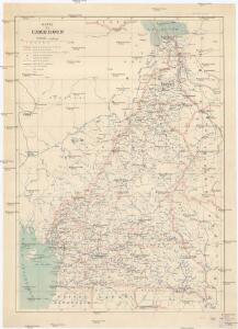
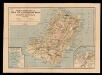
Kamerun
Dorsch, H.
Cameroons under United Kingdom Administration
Carte de l'Afrique occidentale française. Forcados
1 : 2000000 France. Service géographique des colonies [Paris] : Service géographique des colonies
Localisatin of ethnic groups. Southern section. Sheet XI

Vorläufige übersicht von Zintgraff's Reise von Kamerun nach dem Benuë
1 : 3500000 Kamerun C.L. Keller
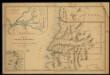
Pays, sud de Howssa et de Bornou. Afrique 29.
1 : 1641836 Vandermaelen, Philippe, 1795-1869
Nigeria

Map of the south-western part of Cameroon (containing the Basel Mission area)

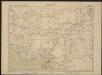
[Ohne Titel]
Mapa de la Guinea Española / formado y publicado por el Depósito de la Guerra
1 : 500000 1 Mapa, col. Finestra: Plano del Rio Muni y sus afluentes Depósito de la Guerra (Espaya)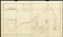
Route sketch of H. Ramsay's expedition in the southern Cameroon regions

Stationen und Arbeitsgebiete der Basler Mission im Grasland v. Kamerun
Tischhauser, G.
Karte des Kamerun-Gebiets

Map of Cameroon, edited by M. Moisel. E2. Banjo.
Sketch of the Bassa region.
Autenrieth
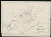
Karte des Gebiets zwischen Bali und Nyasoso, zum Reisebericht Br. Dorsch's
Dorsch, H.
The northern Bulu region according to the survey by First Lieutenant von Glisczinski, Lieutenant Nolte und Dr. Bennett in 1897 and 1898. Designed and drawn by Max Moisel. (Mittheilungen aus den deutschen Schutzgebieten)

Stationsgebiet Mangamba, entworfen nach der Karte von Dr. Esch - Die Flussgebiete des Mongo u. Unteren Wuri.
Dinkelacker, E.
Die Bissagos Inseln und die englischen Niederlassungen Bulama u. Riogrande auf der Westküste von Afrika
Bissagos (Guinea-Bissau) Homann, Johann Baptist Leo Africanus
Carte de Fernando Póo según Pellon / adicionada por los P.F. Misioneros Hijos del I.C. de María
1 Mapa. Pellón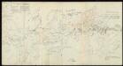
Skizzen aus meinen Reisen in Basa.
Nuevo mapa de la isla de Fernando Póo, vicariato Apostólico
1 Mapa, col. Finestra: Plano de Sta. Isabel Sucesores de Henricy y Ca.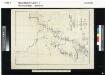
The Cameroon Basin and its feeding rivers. Sheet no. 2. The Wuri & Abo..

[kein Titel]
J. Ittmann
Karte der Pflanzungsgesellschaften (nach Moisel).