Maps of Mayo-Kebbi Est

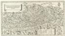
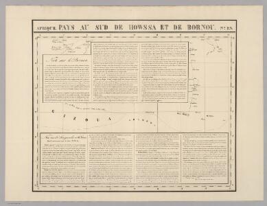
Pays, sud de Howssa et de Bornou. Afrique 29.
1 : 1641836 Vandermaelen, Philippe, 1795-1869
Die Bissagos Inseln und die englischen Niederlassungen Bulama u. Riogrande auf der Westküste von Afrika
Bissagos (Guinea-Bissau) Homann, Johann Baptist Leo Africanus
Carte du Cameroun
1 : 2000000 Kamerun
Cameroons under United Kingdom Administration
Carte de l'Afrique occidentale française. Forcados
1 : 2000000 France. Service géographique des colonies [Paris] : Service géographique des colonies
[Ohne Titel]

Missions Protestantes au Cameroun.

Kamerun mit Togo 1:2 000 000
1 : 2000000 Kamerun Moisel, Max Dietrich Reimer
Kamerun
Dorsch, H.
Schutzgebiete Kamerun und Togo [in vier Blättern] Blatt 1

Cameroon with Togo. Edited by Max Moisel

Dritter Deutscher Kolonialkongress 1910, Sektion IV, Karte 2
Carte des découvertis faites dans le centre de l'Afrique
Afrika střední Oudeney Clapperton Gide fils
West Africa II.
1 : 5600000 Society for the Diffusion of Useful Knowledge (Great Britain)
Aequatorial-West-Afrika
1 : 3000000 Kiepert, Richard ; Sprigade, Paul Geographische Verlagshandlung Dietrich Reimer
Spezial-Karte von Afrika
1 : 4000000 Blatt 5 Habenicht, Hermann Perthes
Neueste Karte von Sudan und Guinea
Grosser Hand-Atlas über alle Theile der Erde in 170 Karten Meyer, J. Verlag des Bibliographischen Instituts
Equatorial West Africa [and] surroundings of Mount Cameroon

Regna Congo et Angola. [Karte], in: Novus atlas absolutissimus, Bd. 6, S. 180.
1 Karte aus Atlas Janssonius Offizin
Sudan, Guinea.
1 : 7250000 Radefeld, Carl Christian Franz, 1788-1874
Afrique equator.le franc.se
1 : 3000000 Afrika střední Meunier, Alexandre
Carte du réseau fluviale navigable de l'Afrique equatoriale française
1 : 3000000 Afrika střední
Northern Nigeria: Native Authority Areas

Nigeria (1907)
Outline map of Northern and Southern Nigeria, TSGS 2235. Shows major rivers, railways, boundaries and towns. Great Britain. General Staff. Topographical Section. [London] : [TSGS, War Office]
Map of the Colony and Protectorate of Nigeria 1929. Drawn and reproduced by the Nigeria Surveys March 1929
Nigeria Surveys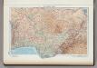
169. Togo, Dahomey, Nigeria. The World Atlas.
1 : 3750000 USSR (Union of Soviet Socialist Republics).
Tchad [Colonie du] (1925)
Afrique Équatoriale Française. Colonie du Tchad. Carte dressée par A. Meunier ... Échelle, 1 : 2,000,000. Paris : Union Graphique.
Afrique equatoriale française
1 : 2000000 Čad Meunier, Alexandre
Vorläufige übersicht von Zintgraff's Reise von Kamerun nach dem Benuë
1 : 3500000 Kamerun C.L. Keller