Maps of Erzgebirge

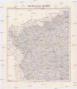
Das westliche Böhmen
1 : 220000 Čechy západní (Česko) Wagner, Jan Eduard F. Kytka
Das westliche Böhmen
1 : 220000 Čechy západní (Česko) Wagner, Jan Eduard F. Kytka
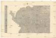
Nr. 17 Franken - Oberpfalz [kaart], uit: Shell Strassenkarte
1 : 470000 Annotatie: Voor aanwezige bladen zie overzichtsblad; Incompleet [S.l. : Shell Reisedienst]
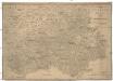
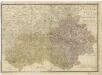
Das Königreich Bayern disseits des Rheins
Grosser Hand-Atlas über alle Theile der Erde in 170 Karten Meyer, J. Verlag des Bibliographischen Instituts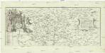
Geographische Mauth-Charte von dem Herzogthum der Ober-Pfalz und der Landgrafschaft Leuchtenberg
Horní Falc (Německo)
Neubertova generální automapa Republiky československé
1 : 200000 Cheb (Česko : oblast) Soukup, Jan V. Neubert a synové
Eisenbahnkarte der k.u.k. oesterreichisch-ungarischen Monarchie

Koenigreich Boehmen...

Geognostisch-Montanistische Übersichts-Karte des Egerer Handelskammer-Gebietes
1 : 290000 Cheb-oblast (Česko) Hickmann, Anton L. Egerer Handelskammer
Übersichts-Karte der bedeutendsten Industrial-Unternehmungen nebst Angabe des Waldterrains
1 : 290000 Cheb-oblast (Česko) Hickmann, Anton L. Egerer Handelskammer
Carte topographique d'Allemagne contenant une partie du royaume de Boheme, une partie de la Saxe
1 Karte : Kupferdruck ; 46 x 61 cm Jaeger; Hauer se vend chez I. W. A. Iaeger
Spezial Karte für Verkehr, landwirtschaftliche, Montan u. gewerbliche Industrie des Bezirkes der Handels und Gewerbekammer Eger
1 : 150000 Aš-oblast (Česko) Daniel, N. R. Lechner
S. R. Imp. Circuli Franconici Geographica Delineatio Francken-Land mit Seinen Gräntzen
Mollova mapová sbírka Endter, Wolfgang Moritz Endter, Wolfgang Moritz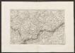
Militair Karte von Süd-Deutschland in 20 Sectionen
1 : 400000 3. Section Coulon, Alois von A. von Coulon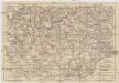
Mittelbach's Strassenprofilkarte des Gebietes der böhmischer Bäder und des Erzgebirges für Rad- und Motorfahrer
1 : 300000 Krušné hory (Česko a Německo) Mittelbach's Verlag
TERRA ADVOCATORVM | Vulgo | VOIGHTLAND
Descripta ab Olao Ioannis Gotho | S.R.M. Sueciæ Geographo. Amstelædami | J. Blaeu excudebat.
Kraj Karlovarský

Terra Advocatorvm vulgo Voightland
1 : 290000 Vogtland (Německo) Örnehufvud, Olof Hansson Blaeu, Joan J. Blaeu
Kraj karlovarský
Elbogner dan Saatzer Kreis und Egerische = Gebiet
Nová Mapa království Českého
1 : 200000 Čechy severozápadní (Česko) Kotyška, Václav Hanf, Norbert Bursík & Kohout
Charte ehemaliger Burgen & Vesten im Elbogner und Saazer Kreise Böhmens
1 : 550000 Loket-oblast (Sokolov, Česko) Heber, Franz Alexander C.W. Medau
Tabulae Marchionatus Brandenburgico-Culmbacensis sive Baruthini Pars Superior cum adjacentibus Regionibus exhibita
1 : 180000 Mollova mapová sbírka Riediger, Johann Adam Seutter, Matthäus
Tabulae principatus Brandenburgico-Culmbacensis sive Baruthini
1 : 225600 Bavorsko severní (Německo) Riediger, Johann Adam Lotter, Tobias Conrad I.A. Riediger
Special-Karte des Egerer Kreis, resp. politischen Verwaltungsbezirkes Königreiche Böhmen
1 : 224000 Cheb-oblast (Česko) Schmidt, Eduard Wendelin Morauer
Special-Karte des Egerer Kreis, resp. politischen Verwaltungsbezirkes Königreiche Böhmen
1 : 224000 Cheb-oblast (Česko) Schmidt, Eduard Steyrer, Fr. C. Wendelin Morauer
Special-Karte des Egerer Kreis, resp. politischen Verwaltungsbezirkes Königreiche Böhmen
1 : 224000 Cheb-oblast (Česko) Schmidt, Eduard Wendelin Morauer
Carte chorographique de la Boheme...

Bayern II.
1 : 650000 Radefeld, Carl Christian Franz, 1788-1874
Elbogner dan Saatzer Kreis und Egerische-Gebiet
1 : 240000 Loket-oblast (Sokolov, Česko) Berndt, Johann Christoph Peter franza [sic]
Elbogner dan Saatzer Kreis und Egerische-Gebiet
1 : 240000 Loket-oblast (Sokolov, Česko) Berndt, Johann Christoph Peter franza [sic]
Elbogner dan Saatzer Kreis und Egerische Gebiet
1 : 240000 Loket-oblast (Sokolov, Česko) Berndt, Johann Christoph Peter Franza
Elbogner dan Saatzer Kreis und Egerische Gebiet
1 : 240000 Loket-oblast (Sokolov, Česko) Berndt, Johann Christoph Peter Franza
Elbogner dan Saatzer Kreis und Egerische Gebiet
1 : 240000 Loket-oblast (Sokolov, Česko) Berndt, Johann Christoph Peter Franza