Maps of England

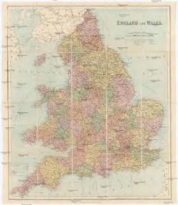
England & Wales
1 : 1075000 Anglie George Philip & Son
[Kaart], uit: W. & A. K. Johnston's touring and motoring map of England and Wales : showing the main roads, and railways
1 : 633600 Edinburgh [etc.] : Johnston
England.
1 : 1220000 Playfair, Principal
Charte von England
Anglie
Charte von England
Anglie
Charte von England
Anglie
CHARTE von ENGLAND
Anglie
Cycling road-map of England & Wales
1 : 1038000 Anglie G. W. Bacon & Co.
[Recto], uit: England and Wales
1 : 1108000 [London] : Philip [etc.]
Angleterre.
1 : 1250000 Vivien St Martin, L.
Kingdoms of the Anglo-Saxons.
Lavoisne, M.
England.
1 : 1100000 Arrowsmith, John
England.
1 : 1090000 Arrowsmith, John
Britanniae sive Angliae regnum
1 : 1300000 Anglie Lotter, Tobias Conrad sumtibus Tob. Conradi Lotter
England.
1 : 1760000 Tanner, Henry S.
England.
1 : 1760000 Tanner, Henry S.
Britannia
1 : 1300000 Anglie Reichard, Christian Gottlieb Campius, D. a D. Campio
Geological map of England and Wales
1 : 1750000 Anglie Murchison, Roderick Impey Malby, T. Chapman & Hall
Smith's new map of England and Wales with parts of Scotland : including the turnpike, and principal crossroads ... / engraved by Edw[ar]d Jones & Benj[ami]n Smith
1 : 1275000 Jones, Edward (fl. 1806); Smith, Benjamin London : C. Smith
Geological map of England and Wales / publ. under the superintendence of the Society for the Diffusion of Useful Knowledge ; arr. by Roderick Impey Murchison ; S.P. Woodward del.; cold. by T. Malby; J. & C. Walker sculpt
1 : 1780000 Annotatie: Oorspr. uitg.: Strand : Chapman and Hall, 1843; Annotatie geografische gegevens: Met aanvullingen tot 1847 Roderick Impey Murchison 1792-1871; S.P. Woodward; T. Malby; Society for the Diffusion of Useful Knowledge London : Knight
Inland navigation, rail roads, geology, minerals of England & Wales.
1 : 1100000 Arrowsmith, John
England
1 : 1380000 Anglie Weiland, Karl Ferdinand Maedel, Carl Jos. Geograph. Institut
England
1 : 1380000 Anglie Weiland, Karl Ferdinand Maedel, Carl Jos. Geograph. Institut
England, Wales.
1 : 2400000 Mitchell, Samuel Augustus
Ireland, Scotland.
1 : 2400000 Mitchell, Samuel Augustus
England, Wales.
1 : 2400000 Mitchell, Samuel Augustus Jr.
England, Wales.
1 : 2400000 Mitchell, Samuel Augustus
England, Wales.
1 : 2400000 Mitchell, Samuel Augustus
The Inland Navigation, Rail Roads, Geology and Minerals of England & Wales.
1 : 1090000 Arrowsmith, John