Maps of England

Britannia
1 : 1300000 Anglie Reichard, Christian Gottlieb Campius, D. a D. Campio
[Kaart], uit: W. & A. K. Johnston's touring and motoring map of England and Wales : showing the main roads, and railways
1 : 633600 Edinburgh [etc.] : Johnston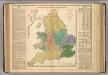
Kingdoms of the Anglo-Saxons.
Lavoisne, M.
England, Wales.
1 : 2400000 Mitchell, Samuel Augustus
Ireland, Scotland.
1 : 2400000 Mitchell, Samuel Augustus
England, Wales.
1 : 2400000 Mitchell, Samuel Augustus Jr.
England, Wales.
1 : 2400000 Mitchell, Samuel Augustus
England, Wales.
1 : 2400000 Mitchell, Samuel Augustus
Angleterre.
1 : 1250000 Vivien St Martin, L.
England & Wales
1 : 1075000 Anglie George Philip & Son
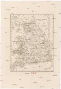
MAGNAE BRITANNIAE
1 : 1340000 Anglie Homann, Johann Baptist Visscher, Nicolaes Jansz. Ioh. Bapt. Homan[n]
England.
1 : 1220000 Playfair, Principal
The Inland Navigation, Rail Roads, Geology and Minerals of England & Wales.
1 : 1090000 Arrowsmith, John
Geological map England, Wales.
1 : 1774080 Letts, Son & Co.
Railway, statistical England, Wales.
1 : 1774080 Letts, Son & Co.
England.
1 : 1900000 Radefeld, Carl Christian Franz, 1788-1874
[Recto], uit: England and Wales
1 : 1108000 [London] : Philip [etc.]
Composite: England.
1 : 755000 Pinkerton, John, 1758-1826
England.
1 : 1760000 Tanner, Henry S.
England.
1 : 1760000 Tanner, Henry S.
Smith's new map of England and Wales with parts of Scotland : including the turnpike, and principal crossroads ... / engraved by Edw[ar]d Jones & Benj[ami]n Smith
1 : 1275000 Jones, Edward (fl. 1806); Smith, Benjamin London : C. Smith
England.
1 : 1090000 Arrowsmith, John
England
1 : 1380000 Anglie Weiland, Karl Ferdinand Maedel, Carl Jos. Geograph. Institut
England
1 : 1380000 Anglie Weiland, Karl Ferdinand Maedel, Carl Jos. Geograph. Institut
Neueste Karte von England
Grosser Hand-Atlas über alle Theile der Erde in 170 Karten Meyer, J. Verlag des Bibliographischen Instituts
Geological map of England and Wales
1 : 1750000 Anglie Murchison, Roderick Impey Malby, T. Chapman & Hall
Ordnance survey map of XVII century England
1 : 1000000 Anglie Ordnance Survey Office
England.
1 : 1100000 Arrowsmith, John
Charte von England
Anglie
Charte von England
Anglie
Charte von England
Anglie