Maps of Pardubický
Komunikační mapa země Moravskoslezské
1 : 100000 Svitavy (Česko : oblast) Morslez. zem. výbor
Chrudimer Kreis

Chrudimer Kreis
1 : 193000 Chrudim-oblast (Česko) Henatsch, Ant. Berndt, Johann Christoph Peter franza [sic]
Chrudimer Kreis
1 : 193000 Chrudim-oblast (Česko) Henatsch, Ant. Berndt, Johann Christoph Peter franza [sic]
Chrudimer Kreis
1 : 193000 Chrudim-oblast (Česko) Henatsch, Ant. Berndt, Johann Christoph Peter franza [sic]
Chrudimer Kreis
1 : 190000 Chrudim-oblast (Česko) Berndt, Johann Christoph Anton Elsenwanger
Chrudimer Kreis
1 : 190000 Chrudim-oblast (Česko) Berndt, Johann Christoph Anton Elsenwanger
Chrudimer Kreis
1 : 200000 Chrudim-oblast (Česko) Anton. Elsenwanger
Chrudimer Kreis
1 : 200000 Chrudim-oblast (Česko) Berndt, Johann Christoph Anton. Elsenwanger
Provincia Chrvdimensis
Chrudim (Česko : oblast) Erber, Bernardinus Winkler, Johann Christoph
Provincia Chrvdimensis
Chrudim-oblast (Česko) Bernardi, Augustin Augustin Bernardi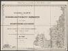
Umgebungen von Zwittau und Mähr. Trübau nebst Titel
1 : 144000 K.K. Militärisches Geographisches Institut
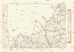
Generalkarte der Bezirkshauptmannschaft Leitomischl
1 : 220000 Litomyšl-oblast (Česko) Wagner, Jan Eduard F. Kytka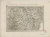
II. vojenské mapování 22
1 : 144000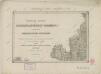
II. vojenské mapování 3
1 : 144000
II. vojenské mapování 3
1 : 144000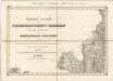
II. vojenské mapování 3
1 : 144000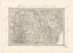
Special - Karte des Koenigreiches Boehmen

Landskorn und Mhr. Trubau.
from Spezialkarte der osterreichisch-ungarischen Monarchie.
Politický okres Vysoké Mýto
1 : 100000 Vysoké Mýto-oblast (Česko) Kratochvíl, M. Josef Richard Vilímek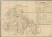
Silniční mapa zámeckého panství Litomyšl
1 : 100300
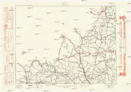
Generální mapa okresních hejtmanství

Hohenmauth und Leitomischl.
from Spezialkarte der osterreichisch-ungarischen Monarchie.
Generální mapa okresního hejtmanství Lanškrounského
1 : 220000 Lanškroun-oblast (Česko) Wagner, Jan Eduard F. Kytka
[Okolí Moravské Třebové
1 : 75000 Letovice (Česko : oblast) Vojenský zeměpisný ústav
Podrobná mapa Markrabství moravského a Vévodství slezkého
1 : 100000 Litomyšl (Česko : oblast) Srp, Jan Jos. R. Vilímek
Podrobná mapa Království českého
1 : 100000 Litomyšl (Česko : oblast) Srp, Jan Jos. R. Vilímek
[Vilímkovy místopisné mapy zemí Koruny české]
1 : 100000 Litomyšl (Česko : oblast) Srp, Jan Jos. R. Vilímek
Polička a okolí
1 : 75000 Polička (Česko : oblast) Vojenský zeměpisný ústav