Maps of New Town

Plán hlavního města Prahy
Malá Strana (Praha, Česko) Havránek, J. A. Čížek
Plánek hlavního města Prahy

3 Tage in Prag
Praha (Česko) Hlávka, Emil Libra, František Albert Autoklub RČS
Grieben-Stadtplan von Prag
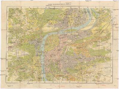
1 : 13000
Hlavní město Praha
Praha (Česko) Hlávka, Emil Koubek, Gustav Autoklub Republiky československé
Hlavní město Praha
Praha (Česko) Hlávka, Emil Koubek, Gustav Autoklub Republiky československé
Grieben-Stadtplan von Prag
1 : 13000
Plán hlavního města Prahy
1 : 10000 Praha (Česko) Jiřík, Rudolf Rudolf Jiřík
Plán hlavního města Prahy
1 : 10000 Praha (Česko) Jiřík, Rudolf Rudolf Jiřík
Prager Stadtplan
1 : 10000 Praha (Česko) Jiřík, Rudolf Rudolf Jiřík
Prager Stadtplan
1 : 10000 Praha (Česko) Jiřík, Rudolf Rudolf Jiřík
Prager Stadtplan
Praha (Česko) Jiřík, Rudolf Tomsa, Josef Rudolf Jiřík
Situations-Plan der königlichen Hauptstadt Prag
Praha (Česko) Loth, Johann Anděl, Bedřich Fiedrich Kretzschmar
[Plán Prahy]
Praha (Česko : oblast) V. Neubert a synové
Orientační plán města Prahy
1 : 13000
Bez titulu: Praha

Bez titulu: Praha

Plán král. hlav. města Prahy a obcí sousedních
Libeň (Praha, Česko) Jos. R. Vilímek
Orientační plán Prahy
1 : 10500 Praha (Česko) Koppe-Bellmann
Kriegs-Expeditions-Karte in Böhmen I. Blat, in welchem die Haubtstadt Prag mit der französsischen und saechsischen Belageru[n]g und Eroberung, so den 26. Novembre 1741. geschehen, vorgestellet wird
1 : 20700 Praha (Česko) Meyer Sinsart von Homaen[n] Erben
Kriegs-Expeditions-Karte in Böhmen I. Blat, in welchem die Haubtstadt Prag mit der französsischen und saechsischen Belageru[n]g und Eroberung, so den 26. Novembre 1741. geschehen, vorgestellet wird
1 : 20700 Praha (Česko) Meyer Sinsart von Homaen[n] Erben
Bez titulu: Plán hlavního města Prahy

Grundriß des K. K. Hauptstadt Prag und ihres nächsten Umgebungen
Wöltner, Leop [s.n.]
Plan of Prague
1 : 16000 V. Neubert a Synové V. Neubert a Synové
Jubilejní plán hlavního města Prahy : [1918-1938]
1 : 12000
Neuester Grundriss von Prag und seiner Umgebung

Praha

Orientační plán Prahy
1 : 10500
Plán hlavního města Prahy
1 : 10000