Maps of České Lhotice

Situations Plan der Umwallung beim Dorfe Hradiště an der Chrudimka unfern Nassaberg im Chrudimer Kreise
1 : 2900 Hradiště (České Lhotice, Česko) Lüssner, Moric Heber, Franz Alexander
Böhmisch Lhotitz (Cesky Lhoticky) - c0971-1-004 - Kaiserpflichtexemplar der Landkarten des stabilen Katasters
1 : 2880
Böhmisch Lhotitz (Cesky Lhoticky) - c0971-1-003 - Kaiserpflichtexemplar der Landkarten des stabilen Katasters
1 : 2880
Böhmisch Lhotitz (Cesky Lhoticky) - c0971-1-002 - Kaiserpflichtexemplar der Landkarten des stabilen Katasters
1 : 2880
Böhmisch Lhotitz (Cesky Lhoticky) - c0971-1-001 - Kaiserpflichtexemplar der Landkarten des stabilen Katasters
1 : 2880
Gradkartenblatt
1 : 25000 Seč-oblast (Chrudim, Česko) Gutwirth, Georg
III. vojenské mapování 4055/4
1 : 25000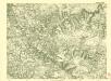
III. vojenské mapování 4055/4
1 : 25000

III. vojenské mapování 4055/2
1 : 25000


Mapa dominikální osady Pláňavy
1 : 2880
Politická mapa okresu chrudimského a nasavrckého
1 : 100000 Chrudim-oblast (Česko) Homolka, Josef Výbor ku popisu okresu chrudimského a nasavrckého
8. Kraj Pardubický

Chrudim a okolí
1 : 75000 Chrudim (Česko : oblast) Vojenský zeměpisný ústav
III. vojenské mapování 4055
1 : 75000
Časlau und Chrudim
1 : 75000 Chrudim (Česko : oblast) Mugerauer K. u. k. militär-geographisches Institut
Časlau und Chrudim
1 : 75000 Chrudim (Česko : oblast) Mugerauer K. u. k. militär-geographisches Institut
Časlau und Chrudim
1 : 75000 Chrudim (Česko : oblast) Mugerauer K. u. k. Militärgeographisches Institut
Mapa horo- a vodopisná okresu chrudimského a nasavrckého
1 : 100000 Chrudim-oblast (Česko) Homolka, Josef Výbor ku popisu okresu chrudimského a nasavrckého
Katastrální mapa města Rabštejn WC-IX-16 af
1 : 2880
Chrudim
1 : 75000 Chrudim-oblast (Česko) Vojenský zeměpisný ústav
[Vilímkovy místopisné mapy zemí Koruny české]
1 : 100000 Chotěboř (Česko : oblast) Srp, Jan Jos. R. Vilímek
Podrobná mapa Království českého
1 : 100000 Chotěboř (Česko : oblast) Srp, Jan Jaroslav Bursík
Politický okres Chrudim
1 : 100000 Chrudim-oblast (Česko) Josef Richard Vilímek
Politický okres Chrudim
1 : 100000 Chrudim-oblast (Česko) Kratochvíl, M. Josef Richard Vilímek
Politický okres Chotěboř
1 : 100000 Chotěboř-oblast (Česko) Kratochvíl, M. Josef Richard Vilímek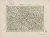
II. vojenské mapování 21
1 : 144000


