Maps of Seč


Podrobná mapa Království českého
1 : 100000 Chotěboř (Česko : oblast) Srp, Jan Jaroslav Bursík
[Vilímkovy místopisné mapy zemí Koruny české]
1 : 100000 Chotěboř (Česko : oblast) Srp, Jan Jos. R. Vilímek
Politická mapa okresu chrudimského a nasavrckého
1 : 100000 Chrudim-oblast (Česko) Homolka, Josef Výbor ku popisu okresu chrudimského a nasavrckého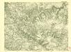
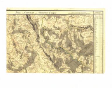
III. vojenské mapování 4055/4
1 : 25000
III. vojenské mapování 4055/4
1 : 25000
Gradkartenblatt
1 : 25000 Seč-oblast (Chrudim, Česko) Gutwirth, Georg
Mapa vrstev vyšinových [sic] nadačního velkostatu Ronov
1 : 25000 Ronov nad Doubravou (Česko) Kautský, Adolf
Gradkartenblatt
1 : 25000 Golčův Jeníkov-oblast (Česko) Gutwirth, Georg
III. vojenské mapování 4055/3
1 : 25000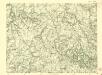
III. vojenské mapování 4055/3
1 : 25000
Kohl Przibram (Uhelná Przibrama) - c8174-1-002 - Kaiserpflichtexemplar der Landkarten des stabilen Katasters
1 : 2880
Kohl Przibram (Uhelná Przibrama) - c8174-1-006 - Kaiserpflichtexemplar der Landkarten des stabilen Katasters
1 : 2880
Kohl Przibram (Uhelná Przibrama) - c8174-1-008 - Kaiserpflichtexemplar der Landkarten des stabilen Katasters
1 : 2880
Kohl Przibram (Uhelná Przibrama) - c8174-1-007 - Kaiserpflichtexemplar der Landkarten des stabilen Katasters
1 : 2880
Kohl Przibram (Uhelná Przibrama) - c8174-1-004 - Kaiserpflichtexemplar der Landkarten des stabilen Katasters
1 : 2880
Kohl Przibram (Uhelná Przibrama) - c8174-1-005 - Kaiserpflichtexemplar der Landkarten des stabilen Katasters
1 : 2880
Kohl Przibram (Uhelná Przibrama) - c8174-1-001 - Kaiserpflichtexemplar der Landkarten des stabilen Katasters
1 : 2880
Kohl Przibram (Uhelná Przibrama) - c8174-1-003 - Kaiserpflichtexemplar der Landkarten des stabilen Katasters
1 : 2880
Nadační velkostatek Ronov
1 : 9000 Ronov nad Doubravou (Česko) Kautský, Ad.
Mirzetitz (Miřetic) - c4710-1-002 - Kaiserpflichtexemplar der Landkarten des stabilen Katasters
1 : 2880
Mirzetitz (Miřetic) - c4710-1-004 - Kaiserpflichtexemplar der Landkarten des stabilen Katasters
1 : 2880
Mirzetitz (Miřetic) - c4710-1-003 - Kaiserpflichtexemplar der Landkarten des stabilen Katasters
1 : 2880
Mirzetitz (Miřetic) - c4710-1-005 - Kaiserpflichtexemplar der Landkarten des stabilen Katasters
1 : 2880
Mirzetitz (Miřetic) - c4710-1-001 - Kaiserpflichtexemplar der Landkarten des stabilen Katasters
1 : 2880
Habern (Haber) - c1739-1-002 - Kaiserpflichtexemplar der Landkarten des stabilen Katasters
1 : 2880
Habern (Haber) - c1739-1-003 - Kaiserpflichtexemplar der Landkarten des stabilen Katasters
1 : 2880
Habern (Haber) - c1739-1-007 - Kaiserpflichtexemplar der Landkarten des stabilen Katasters
1 : 2880
Habern (Haber) - c1739-1-004 - Kaiserpflichtexemplar der Landkarten des stabilen Katasters
1 : 2880
Habern (Haber) - c1739-1-001 - Kaiserpflichtexemplar der Landkarten des stabilen Katasters
1 : 2880
Habern (Haber) - c1739-1-006 - Kaiserpflichtexemplar der Landkarten des stabilen Katasters
1 : 2880