Maps of Czech Republic

Program staveb a úprav státních i nestátních silnic a mostů r. 1939
Protektorát Čechy a Morava Zprávy veřejné služby technické
Přehledná úpatnicová mapa 1:1,000.000
1 : 1000000 Protektorát Čechy a Morava KČT
Übersichtskarte der Protektoratsbahnen Böhmen und Mähren
1 : 400000 Protektorát Čechy a Morava Ministerstvo dopravy
[Protektorát Čechy a Morava - výdej a odběr pohonných látek]
Protektorát Čechy a Morava
Gewässerkarte der Sudetenländer 1:750.000
1 : 750000 Sudety (Česko) Schreier, Maximilian Geographisches Institut der Deutschen Universität in Prag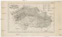
Zeměznalecký přehled Čech, Moravy a částí Slezska
Česko Hollmann, Jos. Taafe, Ludvík
Soubor němých map pro střední školy

Mapa Čech a země Moravskoslezské s označením státních silnic v barvách dle nejnovějších nařízení

Protektorát Čechy a Morava

Dr. A. Oberschall's Sprachenkarte der Tschechoslowakischen Republik.
Česko Oberschall, Albin Hocke, Jan Deutschpolitischen Arbeitsstelle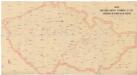
Mapa doktorů a absolv. techniků s 2. stát. zkouškou od r. 1882-83 do 1892-93
Česko Horák, František Doležal, Bohumil
Viseci [sic] mapa Království českého
1 : 200000 Česko Kocen, Blaž Erben, Josef Eduarda Hölzel
Protektorat Böhmen und Mähren
1 : 650000 Protektorát Čechy a Morava Národní autoklub Čech a Moravy
Mapa hlavních silničních spojů v Protektorátu Čechy a Morava
Protektorát Čechy a Morava Národní autoklub Čech a Moravy
Mapa o stavu silnic v Protektorátu Čechy a Morava
1 : 600000 Protektorát Čechy a Morava Národní autoklub Čech a Moravy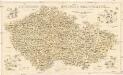
Kulturní mapa země České a Moravskoslezské
1 : 530000 Brno (Česko) Lauda, Ladislav Šolc a Šimáček
Specielle Telegrafen- und Eisenbahnkarte von Böhmen
1 : 421000 Čechy (Česko) Hollmann, Jos. Jos. Hollmann
Specielle Telegrafen- und Eisenbahnkarte von Böhmen
Čechy (Česko) Hollmann, Jos. Taafe, Ludvík Friedrich Ehrlich
Čechy, Morava a Slezsko
Morava (Česko) Studnička, Alois Karel Janský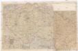
[Protektorát Čechy a Morava]
1 : 400000 Protektorát Čechy a Morava Machát, František
Tschechische Republik 2001. Schlesier (slezská národnost)
Tschechische Republik ethnische Gruppe, Schlesier Hofinger, Veronika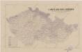
Sbírka map a diagramů použitých na mírových konferencích v Paříži v letech 1919 - 1920

Mapa relativních přebytků a nedostatků normálních srážek
Česko Státní ústav hydrologický T. G. Masaryka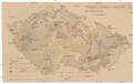
Mechanisch-physikalische Bodenkarte der Sudetenländer
1 : 750000 Česko Niethammer, A.
Das Deutsche Sprachgebiet in den Sudetenländern

Tschechische Republik 2001. Slowaken (slovenská národnost)
Tschechische Republik ethnische Gruppe, Slowaken Hofinger, Veronika
Sprachenkarte der Tschechoslovakien Republik.
Česko Sobota, Emil Hocke, Jan Deutschpolitischen Arbeitsstelle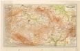
Grossdeutsches Reich Sudetenländer

Tschechische Republik 2001. Tschechen (česká národnost)
Tschechische Republik ethnische Gruppe, Tschechen Hofinger, Veronika


