Maps of Vysoká Pec

Snímek s [sic] mapy katastrální obce Eisenberg
Jezeří (Horní Jiřetín, Česko)
Eisenberg - c2880-1-005 - Kaiserpflichtexemplar der Landkarten des stabilen Katasters
1 : 2880
Eisenberg - c2880-1-004 - Kaiserpflichtexemplar der Landkarten des stabilen Katasters
1 : 2880
Eisenberg - c2880-1-001 - Kaiserpflichtexemplar der Landkarten des stabilen Katasters
1 : 2880
Eisenberg - c2880-1-002 - Kaiserpflichtexemplar der Landkarten des stabilen Katasters
1 : 2880
Eisenberg - c2880-1-006 - Kaiserpflichtexemplar der Landkarten des stabilen Katasters
1 : 2880
Eisenberg - c2880-1-003 - Kaiserpflichtexemplar der Landkarten des stabilen Katasters
1 : 2880
Geologische und Gruben-Revier-Karte des Kohlenbeckens von Teplitz-Dux-Brüx
1 : 10000 Blatt 3 Wolf, Heinrich Lithografie u. Schnell-Pressen-Druck des k.k. Militär-geografischen Institutes
[Brüx und Umgebung]
Most-oblast (Česko) Kreibich, František Jakub Jindřich
[Kartenblatt]
1 : 25000 Horní Jiřetín-oblast (Česko) Reichsamt für Landesaufnahme
[Kartenblatt]
1 : 25000 Horní Jiřetín-oblast (Česko) Reichsamt für Landesaufnahme

III. vojenské mapování 3751/3
1 : 25000
Československo v mapách

Orientierungs-Plan des Strassennetzes der Komotau-Sebastiansberger-Bez. Vertretung mit Inbegriff der eventuell zum Flusbau Kommenden Strassen-Strecken
1 : 75000 Chomutov-oblast (Česko) Loquens, Jos. Bormann, E.
Chomutov a okolí
1 : 75000 Chomutov (Česko : oblast) Vojenský zeměpisný ústav
Soubor přehledných map pro plánování a statistiku: 3751 – Teplice

III. vojenské mapování 3751
1 : 75000
Brüx, Dux und Teplitz
1 : 75000 Duchcov (Česko : oblast) Hübner K. u. k. militär-geographisches Institut
Brüx, Dux und Teplitz
1 : 75000 Duchcov (Česko : oblast) Hübner K. u. k. Militärgeographisches Institut
Brüx, Dux und Teplitz
1 : 75000 Duchcov (Česko : oblast) K. u. k. Militärgeographisches Institut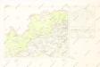
Mapy plánování ČSR

Geologische Uebersichtskarte von Teplitz, Bilin, Dux, Brüx un Umgegend
1 : 100000 Teplice-oblast (Česko) Marischler, Norbert Wolf, H. Adolf Becker
Politischer Bezirk Brüx

Most a okolí
1 : 75000 Most (Česko : oblast) Vojenský zeměpisný ústav
Teplice
1 : 75000 Teplice (Česko : oblast) Vojenský zeměpisný ústav
Teplice
1 : 75000 Teplice-oblast (Česko) Vojenský zeměpisný ústav
Karte der Bezirke Brüx & Teplitz
1 : 100000 Most-oblast (Česko) Stelzig, Heinrich Heinrich Stelzig
Nová Mapa království Českého
1 : 200000 Čechy severozápadní (Česko) Kotyška, Václav Hanf, Norbert Bursík & Kohout
![Snímek s [sic] mapy katastrální obce Eisenberg](https://images-0.georeferencer.com/images/iiif/047734375942/full/,300/0/native.jpg)

