Maps of New York
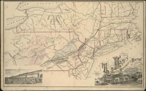
Map of the South Mountain and Boston Railroad & connections showing territory passed through, rail-roads and canals crossed or connected with, together with mineral and geographical features of country passed through
(Penn., N.Y., New England) Railroad Map of the United States.
1 : 506880 Rand McNally and Company
Massachusetts, Rhode Island, and Connecticut. New York.
1 : 1000000 Schonberg & Co.
132-33. Mass., Conn., R.I., N.J., Del., Md.
1 : 1500000 Touring club italiano
Karte von Neu England, Neu Yorck und Pensilvanien

State of New York.
1 : 300000 French, C.E.
Map of the state of New York : showing the boundaries of counties & townships, the location of cities, towns and villages, the courses of rail roads, canals & stage roads / by J. Calvin Smith ; engraved on steel by Sherman & Smith.
from Whole
Map of the meetings constituting New York Yearly Meeting of Friends.
from Whole
Map of the state of New York : compiled from the latest authorities.
from Whole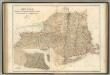
New York, Vermont, New Hampshire, Rhode Island, Massachusetts & Connecticut.
1 : 1570000 Black, Adam & Charles
Pensylvania Nova Jersey et Nova York cum Regionibus ad Fluvium Delaware in America sitis
1 : 1000000 Lotter, Tobias Conrad
New York.
1 : 3674880 Scott, Joseph
A map of the state of New York : compiled from the latest authorities, including the turnpike roads now granted as also the principal common roads connected therewith
1 : 1350000 McCalpin, William
New York, Buffalo, Boston.
Rand McNally and Company
[Map of part of New York State between Albany and Buffalo : showing Erie Canal and other transportation routes] / D.W. Wilson, sc. Albany.
from (A-Z)
Map of the state of New York: showing the boundaries of counties & townships, the location of cities, towns and villages: the courses of railroads, canals & stage roads / by J. Calvin Smith; engraved on steel by Sherman & Smith.
from Whole J. Calvin Smith; Sherman & Smith,
Map of the state of New York: showing the boundaries of counties & townships, the location of cities, towns and villages, the courses of rail roads, canals & stage roads / by J. Calvin Smith; engraved on steel by Sherman & Smith.
from Whole J. Calvin Smith; Sherman & Smith,
New York.
1 : 570000 Rand McNally and Company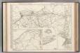
New York.
Rand McNally and Company
State of New York, Jany. 1, 1824: for Spafford's gazetteer.
from Whole Spafford,
A chorographical map of the province of New-York in North America, divided into counties, manors, patents and townships : exhibiting likewise all the private grants of land made and located in that Province / compiled from actual surveys deposited in the
from Whole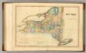
New York.
1 : 1740000 Lucas, Fielding Jr.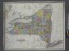
New York / by H.S. Tanner.
from Whole Henry S. Tanner,
The Empire State, New York: with its counties, towns, cities, villages, internal improvements &c. / drawn & engraved by J. H. Young.
from Whole J. H. Young,
Map of the state of New York: showing the boundaries of counties & townships, the location of cities, towns and villages, the courses of rail roads, canals & stage roads / by J. Calvin Smith; engraved on steel by Sherman & Smith.
from Whole J. Calvin Smith; Sherman & Smith,
Map of the state of New York: showing the boundaries of counties & townships, the location of cities, towns and villages, the courses of rail roads, canals & stage roads / by J. Calvin Smith; engraved on steel by Sherman & Smith.
from Whole J. Calvin Smith; Sherman & Smith,
New York / by H.S. Tanner; engraved ... by H.S. Tanner.
from Whole Henry S. Tanner,
The state of New York from the most recent surveys.
from Whole Published by E. Huntington: Hartford, Conn.; Huntington, Eleazar,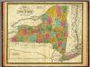
State of New York.
1 : 1330560 Mitchell, Samuel Augustus
The tourist's map of the state of New York: compiled from the latest authorities in the Surveyor General's office / engraved by Balch, Stiles & Co., N. York.
from Whole Balch, Stiles & Co.,,
Map of the state of New-York with part of the states of Pennsylvania, New-Jersey, &c. / compiled, corrected & published from the most recent authorities and accurate surveys by Amos Lay, 1817.
from Parts Amos Lay,
New York.
1 : 2700000 Lewis, Samuel