Maps of Massachusetts
Map of Massachusetts

An accurate map of the Commonwealth of Massachusetts exclusive of the District of Maine : compiled pursuant to an act of the General Court from actual surveys of the several towns &c. taken by their order, exhibiting the boundary lines of the Commonwealth, the counties and towns, the principal roads, rivers, mountains, mines, islands, rocks, shoals, channels, lakes, ponds, falls, mills, manufactures & public buildings, with the true latitudes & longitudes, &c : Eastern sheet
1 : 281560 Carleton, Osgood, 1742-1816 Published and sold by O. Carleton and I. Norman
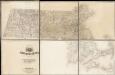
An accurate map of the Commonwealth of Massachusetts exclusive of the District of Maine : compiled pursuant to an act of the General Court from actual surveys of the several towns &c. taken by their order, exhibiting the boundary lines of the Commonwealth, the counties and towns, the principal roads, rivers, mountains, mines, islands, rocks, shoals, channels, lakes, ponds, falls, mills, manufactures & public buildings, with the true latitudes & longitudes, &c : Western sheet
1 : 281560 Carleton, Osgood, 1742-1816 Published and sold by O. Carleton and I. Norman
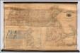
The state of Massachusetts from the best information
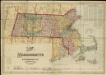
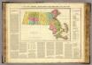
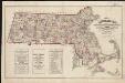
Massachusetts
Massachusetts.
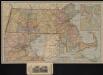
1 : 590000 Rand McNally and Company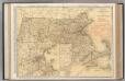
Massachusetts.
1 : 444000 Rand McNally and Company
Massachusetts.
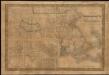
1 : 1130000 Tanner, Henry S.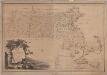
Map of Massachusetts proper : compiled from actual surveys made by order of the General Court
1 : 253440 Carleton, Osgood, 1742-1816 [B. & J. Loring]
Colton's Massachusetts and Rhode Island
1 : 800000 G.W. & C.B. Colton & Co. G.W. & C.B. Colton & Co.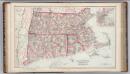
Massachusetts, Rhode Island, and Connecticut.
1 : 570000 Gray, Frank A.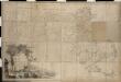
Map of Massachusetts proper compiled from actual surveys made by order of the General Court
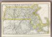
Massachusetts.
1 : 685000 Buchon, J. A. C.; Carey, H. C.; Lea, I.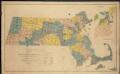
Map of senatorial districts of Massachusetts, as established by the legislature of 1886
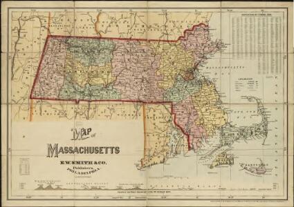
Map of Massachusetts
Map of Massachusetts to accompany the Massachusetts register & business directory
[Map] of the state of Massachusetts
Map Of Massachusetts
1 : 158400 Borden, Simeon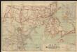
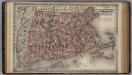
Map of Massachusetts

Massachusetts and Rhode Island.
1 : 1000000 Mitchell, Samuel Augustus
Massachusetts and Rhode Island.
1 : 1000000 Mitchell, Samuel Augustus
Massachusetts and Rhode Island.
1 : 785000 Colton, G.W.
Massachusetts
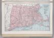
Massachusetts, Connecticut, and Rhode Island.
1 : 759000 Hammond, C.S.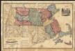
Russell's map of Massachusetts

Massachusetts.
1 : 1150000 Finley, Anthony
Neueste Karte von Massachusetts und Rhode Island
Grosser Hand-Atlas über alle Theile der Erde in 170 Karten Meyer, J. Verlag des Bibliographischen Instituts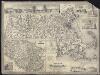
Map of Massachusetts
A new map of Massachusetts compiled from the latest and best authorities