Maps of Asia
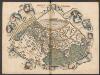
Generale Ptholemei [Karte], in: Claudii Ptolemei viri Alexandrini mathematice discipline philosophi doctissimi geographie opus [...], S. 148.
1 Karte aus Atlas Waldseemüller, Martin [und Ptolemaeus, Claudius] Übelin, Georg
Orbis Terrarum Veteribus Cogniti Typus Geographicus. [Karte], in: Novus atlas absolutissimus, Bd. 10, S. 8.
1 Karte aus Atlas Janssonius Offizin
Vertheilung der Luftströmungen
země světa Gräf, C. Dellinger, A. Geographisches Institut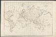
Allgemeine Weltcharte
1 : 45400000 nach Mercators Projection entworfen von A.I. Krusenstern, Capitain der Russischen Marine J. Walker sculpt. ; verb. bis zum Jahre 1818. London : [s.n.]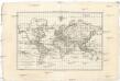
Carte générale de toutes les parties connues de la surface de la terre en carte réduite
země světa Bonne, Rigobert
Asia
Hand-Atlas über alle Theile der Erde nach dem neuesten Zustande und über das Weltgebäude Stieler, Adolf bei Justus Perthes
Atlas über die Entwicklung von Industrie und Handel der Schweiz in dem Zeitraume vom Jahr 1770 bis zum Jahr 1870
1 : 500000 Absatzgebiete des Schweizerischen Ausfuhrhandels 1770 Wartmann, Hermann Wurster Randegger & Co.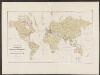
Atlas über die Entwicklung von Industrie und Handel der Schweiz in dem Zeitraume vom Jahr 1770 bis zum Jahr 1870
1 : 500000 Orientierungsblatt Absatzgebiete Wartmann, Hermann Wurster Randegger & Co.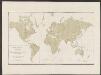
Atlas über die Entwicklung von Industrie und Handel der Schweiz in dem Zeitraume vom Jahr 1770 bis zum Jahr 1870
1 : 500000 Absatzgebiete des Schweizerischen Ausfuhrhandels 1820 Wartmann, Hermann Wurster Randegger & Co.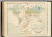
Health, disease.
1 : 67000000 Johnston, Alexander Keith, 1804-1871
Planisphere physique.
1 : 60000000 L'Isle, Guillaume de, 1675-1726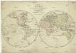
Karte von der Erde oestlicher und westlicher Halbkugel
země světa Reilly, Franz Johann Josef von Alberti, Ignaz von Franz Ioh. Ios. von Reilly
Orbis terrae compendiosa descriptio
země světa Mercator, Rumold Porro, Girolamo Rumoldus Mercator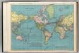
World on Mercator's Projection.
1 : 60000000 Rand McNally and Company
Asia
Stieler's Hand-Atlas Stieler, Adolf bei Justus Perthes
Charte über die verschiedenen jezt auf der Erde herrschenden Religionen
země světa im Verlage des Landes Industrie Comptoirs
Carte réduite d'apres celle de Laperouse
1 : 90000000 země světa La Pérouse, Jean-François de Galaup
[Zoological Geography, Geographical Division & Distribution of Carnivora]
The physical atlas Johnston, Alexander Keith William Blackwood & Sons
Verbreitung der Vögel II.
Atlas der Tierverbreitung Marshall, William Justus Perthes
Linien gleicher magnetischer Inklination (Isoklinen)
Atlas des Erdmagnetismus Neumayer, Georg Justus Perthes
Atlas über die Entwicklung von Industrie und Handel der Schweiz in dem Zeitraume vom Jahr 1770 bis zum Jahr 1870
1 : 500000 Absatzgebiete des Schweizerischen Ausfuhrhandels 1870 Wartmann, Hermann Wurster Randegger & Co.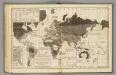
Moral, political World.
1 : 133000000 Woodbridge, William C.
Verbreitung der Vögel I.
Atlas der Tierverbreitung Marshall, William Justus Perthes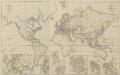
XIII. Charte für die allgemeine Geschichte von Friedrich IIten Tode bis auf den Frieden von Presburg : d.i. von 1786 bis 1805 n. Christus
Entworfen von F.W. Benicken grav. von A. Falger Weimar : im Verlage des L. Industrie-Comptoirs
[Survey of the Geographical distribution and cultivation of the most important Plants which are used as food for man]
The physical atlas Johnston, Alexander Keith William Blackwood & Sons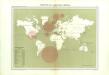
Atlas du Comité central des houilleres de France: Cartes des bassins houillers de la France, de la Grande-Bretagne, de la Belgique et de l'Allemagne

Weltkarte zur Uebersicht der vorzügluchsten Varietaeten des Menschen, nach Blumenbach'schen Systeme
1 : 82300000 entworfen und gezeichnet von C.F. Weiland nach Bory de St. Vincent entworfen und gezeichnet von C.F. Weiland Weimar : Im Verlage des Geograph. Instituts
Planisphere physique où l'on voit du pole septentrional ce que l'on connoît de terres et de mers
1 Karte : Kupferdruck ; Durchmesser 34 cm Buache; Dezauche; Desbruslins chez Dezauche succ.r des Srs. De l'Isle et Buache ... rue des Noyers près celle des Anglois
Planisphere physique où l'on voit du pole septentrional ce que l'on connoît de terres et de mers
1 Karte : Kupferdruck ; Durchmesser 34 cm, Blattgrösse 46 x 60 cm Buache; Desbruslins Philippe Buache sur le quay de l'Horloge du Palais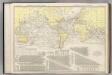
![Generale Ptholemei [Karte], in: Claudii Ptolemei viri Alexandrini mathematice discipline philosophi doctissimi geographie opus [...], S. 148.](https://images-2.georeferencer.com/images/iiif/818677974369/full/,300/0/native.jpg)

