Maps of Hauts-de-France
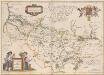
Picardia Regio Belgica [Karte], in: Theatrum orbis terrarum, sive, Atlas novus, Bd. 2, S. 32.
1 Karte aus Atlas Blaeu, Joan Blaeu, Willem Janszoon
Picardia Regio Belgica [Karte], in: Le théâtre du monde, ou, Nouvel atlas contenant les chartes et descriptions de tous les païs de la terre, Bd. 2, S. 29.
1 Karte aus Atlas Blaeu, Willem Janszoon und Blaeu, Joan Blaeu, Willem Janszoon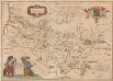
Picardia Regio Belgica [Karte], in: Novus Atlas, das ist, Weltbeschreibung, Bd. 2, S. 29.
1 Karte aus Atlas Blaeu, Joan Blaeu, Willem Janszoon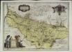
Picardia regio belgica
1 Karte : Kupferdruck ; 37 x 51 cm Blaeu; Blaeu; Surhon; Surhon apud Guiljelmum et Joannem Blaeu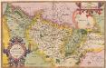
Picardiae, Belgicae regionis descriptio. [Karte], in: Theatrum orbis terrarum, S. 83.
1 Karte aus Atlas Ortelius, Abraham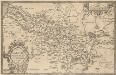
Picardiae, Belgicae regionis descriptio. [Karte], in: Theatrum orbis terrarum, S. 140.
1 Karte aus Atlas Ortelius, Abraham Vrients, Jan Baptista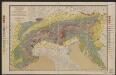
Picardia [Karte], in: Gerardi Mercatoris et I. Hondii Newer Atlas, oder, Grosses Weltbuch, Bd. 2, S. 29.
1 Karte aus Atlas Mercator, Gerhard und Hondius, Jodocus Jansson, Jan
Artesia comit
1 Karte : Kupferdruck ; 33 x 43 cm Mercator; Hondius Henricus Hondius
Artesia comit
1 Karte : Kupferdruck ; 33 x 43 cm Hondius; Mercator Jodocus Hondius
Artesia comit
1 Karte : Kupferdruck ; 33 x 43 cm Mercator s.n.
Theatre de la Guerre
1 : 465000 Mollova mapová sbírka Ottens, Joachim Keyser, Jacob Ottens, Joachim
Carte du gouvernement general de Picardie qui comprend la generalité d'Amiens avec l'Artois & les frontieres des Pays Bas
1 : 400000 dressée sur le dessin des cartes de Mr. de l'Isle [Nürnberg] : publ. par les Heritiers de Homan
Carte du govvernement general de Picardie qui comprend la generalité d'Amiens avec l'Artois [et] les frontieres des Pays Bas
1 Karte : Kupferdruck ; 46 x 55 cm L'Isle les Heritiers de Homan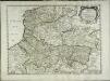
Gouvernement general de la Picardie, Artois, Boulenois, et pays reconquis [et]c
1 Karte : Kupferdruck ; 38 x 51 cm Sanson; Mariette; Somer chez Pierre Mariette rue St. Jacques a l'esperance
Artesia Comit: [Karte], in: Gerardi Mercatoris Atlas, sive, Cosmographicae meditationes de fabrica mundi et fabricati figura, S. 308.
1 Karte aus Atlas Mercator, Gerhard Montanus, Petrus
Præfectura Picardiæ
1 Karte : Kupferdruck ; 47 x 58 cm Valck; Valck G. und L. Valck
Picardie, Artois, Boulenois, Flandre françoise, Haynaut et Cambrésis
1 Karte : Kupferdruck ; 51 x 64 cm Robert de Vaugondy; Fortin; Arrivet; Dussy chés Fortin ing.r mécanicien du roy rue de la Harpe
Gouvernement général de Picardie et Artois
1 Karte : Kupferdruck ; 46 x 57 cm Robert de Vaugondy G. et D. Robert de Vaugondy

Carte du GOVVERNEMENT GENERAL DE PICARDIE
1 : 380000 Amiens-oblast (Francie) Delisle, Guillaume par les Heritiers de Homan
Carte du GOVVERNEMENT GENERAL DE PICARDIE
1 : 406000 Amiens-oblast (Francie) Delisle, Guillaume par les Heritiers de Homan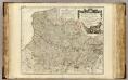
Picardie, Artois, Flandre Francoise.
1 : 400000 Robert de Vaugondy, Gilles, 1688-1766
Gouvernement de Picardie
1 Karte : Kupferdruck ; 31 x 42 cm Mentelle; Tardieu; Dubuisson Mentelle
Artois Picardie
1 Karte : Kupferdruck ; 20 x 27 cm Crépy Crépy
Picardia
1 Karte : Kupferdruck ; 36 x 48 cm Mercator; Hondius Henricus Hondius
Picardia
1 Karte : Kupferdruck ; 36 x 49 cm Janssonius apud Ioannem Ianssonium
Picardiae, Belgicae regionis descriptio
1 : 66000
Picardia
1 : 361000 Pikardie (Francie)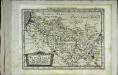
Picardia
1 Karte : Kupferdruck ; 17 x 24 cm Mercator; Keere Cloppenburgh
![Picardia Regio Belgica [Karte], in: Theatrum orbis terrarum, sive, Atlas novus, Bd. 2, S. 32.](https://images-2.georeferencer.com/images/iiif/670455856555/full/,300/0/native.jpg)

