Maps of South America
America [Karte], in: Gerardi Mercatoris Atlas, sive, Cosmographicae meditationes de fabrica mundi et fabricati figura, S. 547.
1 Karte aus Atlas Mercator, Gerhard Montanus, Petrus
Atlantischer Ocean.
1 : 61000000 Andree, Richard
Atlantic
1 : 60000000 Andree, Richard; Times (London, England)
Atlantic Ocean.
1 : 60000000 Smiley, Thomas T.
Atlantic Ocean
1 : 20000000 Atlantský oceán National Geographic Society
Composite: Atlantic Ocean.
1 : 25000000 John Bartholomew & Co.
IV. Isothermal chart of the Atlantic Ocean for March and September
Maury, Matthew Fontaine
Nova & accuratissima totius terrarum orbis tabula nautica, 2
1 Blatt : 51 x 52 cm R. & I. Ottens
Atlantic cables, wireless stations.
1 : 40000000 Philip, George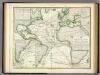
Karte vom Atlantischen Ocean.
1 : 90000000 Berghaus, Heinrich
Carte d'Amerique divisées en ses principales parties
1 : 36000000 par G. de L'Isle, premier geographe du roy rectifieé apres les nouvelles observations du Sr. d'Anville et autres geographes ; J. Condet, sc. A Amsterdam : chez Covens & Mortier & Covens Junior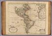
Carte d'Amerique.
1 : 31000000 L'Isle, Guillaume de, 1675-1726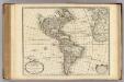
Carte d'Amerique.
1 : 31000000 L'Isle, Guillaume de, 1675-1726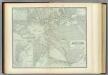
Atlantic Ocean.
1 : 31000000 Johnston, Alexander Keith, 1804-1871
America.
1 : 75000000 Moll, Herman, d. 1732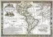
L'Amerique meridionale et septentrionale
1 Karte : Kupferdruck ; 42 x 63 cm Nolin; Jean; Boniselle chez Jean rue Jean de Beauvais n.o 32
Atlantic Ocean.
1 : 45000000 Lizars, W. H. (William Home)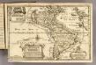
L'Amerique.
1 : 64000000 Fer, Nicolas de, 1646-1720
Der Atlantische Ozean
1 : 40000000 Atlantský oceán (oblast) Groll, Max Institut für Meereskunde der Universität
Carte d'Amérique
1 Karte : Kupferdruck ; 49 x 67 cm Poirson; Jean chez Jean rue Jean de Beauvais no. 32
Carte d'Amérique
1 Karte : Kupferdruck ; 46 x 59 cm L'Isle; Buache; Dezauche chez l'auteur rue des Noyers
America
Amerika Verlage des Kunst und Industrie Comptoirs
A general chart of the West India's [sic] / by John Seller, His Maties. hydrographer.
from Atlas maritimus, or, A book of charts
Composite: America.
1 : 13000000 Robert Laurie & James Whittle
Composite: America.
1 : 12800000 Sayer, Robert
La America
1 Karte : Kupferdruck ; 45 x 51 cm s.n.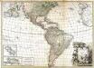
L'Amerique
1 Karte auf 2 Blatt : Kupferdruck ; 70 x 98 cm Bonne; Lattré chez Lattré grav. ord. du roi de M. le duc d'Orléans et de la ville rue St. Jacques
America
Amerika im Verlage des Kunst und Industrie Comptoirs
America
Amerika im Verlage des Kunst und Industrie Comptoirs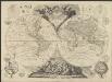
![America [Karte], in: Gerardi Mercatoris Atlas, sive, Cosmographicae meditationes de fabrica mundi et fabricati figura, S. 547.](https://images-2.georeferencer.com/images/iiif/111318437199/full/,300/0/native.jpg)

