Maps of Rhodes Regional Unit
Rhodus Ins. [Karte], in: Gerardi Mercatoris Atlas, sive, Cosmographicae meditationes de fabrica mundi et fabricati figura, S. 523.
1 Karte aus Atlas Mercator, Gerhard Montanus, Petrus
Archipelagi Insularum Aliquot Descrip., [Rodus] [Karte], in: Theatrum orbis terrarum, S. 341.
1 Karte aus Atlas Ortelius, Abraham Vrients, Jan Baptista
Archipelagi Insularum Aliquot Descrip., [Rodus] [Karte], in: Theatrum orbis terrarum, S. 246.
1 Karte aus Atlas Ortelius, Abraham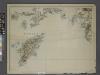
Sheet 14. 1: 250,000. / dressée par Henri Kiepert d'après ses propres observations et d'autres levées pour la plupart inédites = Map of the western part of Asia Minor
From Specialkarte vom westlichen Kleinasien nach seinen eigenen Reisen und anderen grösstenteils noch unveröffentlichten Routenaufnahmen bearbeitet von Heinrich Kiepert = Carte de la partie occidentale de l 'Asie mineure
Insular. Aliquot Aegaei Maris Antiqua Descrip.[:] [Rhodus.] [Karte], in: Theatrum orbis terrarum, S. 419.
1 Karte aus Atlas Ortelius, Abraham
Insular. Aliquot Aegaei Maris Antiqua Descrip.[:] [Rhodus.] [Karte], in: Theatrum orbis terrarum, S. 517.
1 Karte aus Atlas Ortelius, Abraham Vrients, Jan Baptista
Kos, Nisero and Piscopi (1848)
Archipelago. The Islands of Kos, Nisero and Piscopi, etc.
Isola Di Piscopi, Dodecanese Islands 1:25,000 (1953)
Sheet 24 of the 53-sheet series: Dodecanese Islands 1:25,000, A.M.S. Series M801. Relief shown by contours, spot heights and rock drawings. Contour interval: 10 m. United States. Army. Corps of Engineers Washington, D.C. : Army Map Service, Corps of Engineers, U.S. Army.
Carta topografica dell'isola di Rodi
1 : 25000 Rhodos, ostrov (Řecko) Istituto geografico militare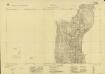
Isola di Scarpanto, Olimbo
Sheet 2 of the six-sheet series: Isola di Scarpanto. Istituto Geografico Militare. Rilievo del 1933. G.S.G.S. 4102. [London] : [War Office]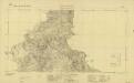
Isola di Scarpanto, Messocorio
Sheet 4 of the six-sheet series: Isola di Scarpanto. Istituto Geografico Militare. Rilievo del 1933. G.S.G.S. 4102. [London] : [War Office]
Rhodes, DR 47, Monolito
Rhodes, DR 47.Copied from an Italian map dated 1935. Great Britain. Army. Royal Engineers. Field Survey Company, 512th. [Cairo] : [Survey Directorate, Middle East]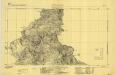
Scarpanto, Mediterranean Sea, Messocorio
Sheet F4 of the six-sheet series: Isola di Scarpanto. Istituto Geografico Militare. Rilievo del 1933. G.S.G.S. 4102. [London] : [War Office]
Rhodes, DR 47, Lardo
Rhodes, DR 47. Copied from an Italian map dated 1935. Great Britain. Army. Royal Engineers. Field Survey Company, 512th. [Cairo] : [Survey Directorate, Middle East]
Rhodes, DR 47, Salaco
Rhodes, DR 47. Copied from an Italian map dated 1935. Great Britain. Army. Royal Engineers. Field Survey Company, 512th. [Cairo] : [Survey Directorate, Middle East]
Rhodes, DR 47, Castello
Rhodes, DR 47. Copied from an Italian map dated 1935. Great Britain. Army. Royal Engineers. Field Survey Company, 512th. [Cairo] : [Survey Directorate, Middle East]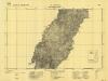
Scarpanto, Mediterranean Sea, M. Cimara
Sheet F3 of the six-sheet series: Isola di Scarpanto. Istituto Geografico Militare. Rilievo del 1933. G.S.G.S. 4102. [London] : [War Office]
Rhodes, DR 47, Monte Attario
Rhodes, DR 47. Copied from an Italian map dated 1935. Great Britain. Army. Royal Engineers. Field Survey Company, 512th. [Cairo] : [Survey Directorate, Middle East]
Rhodes, DR 47, Trianda
Rhodes, DR 47. Copied from an Italian map dated 1935. Great Britain. Army. Royal Engineers. Field Survey Company, 512th. [Cairo] : [Survey Directorate, Middle East]
Rhodes, DR 47, Afando
Rhodes, DR 47. Copied from an Italian map dated 1935. Great Britain. Army. Royal Engineers. Field Survey Company, 512th. [Cairo] : [Survey Directorate, Middle East]
Carta dell’isola di Coo (Kos) (Sheet 2)
This map series - Carta dell'isola di Coo (Kos), Series GSGS 4103 - provides coverage of the Greek island of Coo [Kos] in five sheets. The map content was copied directly from Italian maps that were surveyed in 1925. Great Britain. War Office. General Staff. Geographical Section. [London] : War Office
Rhodes, DR 47, Alaerma
Rhodes, DR 47.Copied from an Italian map dated 1935. Great Britain. Army. Royal Engineers. Field Survey Company, 512th. [Cairo] : [Survey Directorate, Middle East]
Rhodes, DR 47, Apollona
Rhodes, DR 47. Copied from an Italian map dated 1935. Great Britain. Army. Royal Engineers. Field Survey Company, 512th. [Cairo] : [Survey Directorate, Middle East]
Rhodes, DR 47, Malona
Rhodes, DR 47. Copied from an Italian map dated 1935. Great Britain. Army. Royal Engineers. Field Survey Company, 512th. [Cairo] : [Survey Directorate, Middle East]
Carta dell’isola di Coo (Kos) (Sheet 4)
This map series - Carta dell'isola di Coo (Kos), Series GSGS 4103 - provides coverage of the Greek island of Coo [Kos] in five sheets. The map content was copied directly from Italian maps that were surveyed in 1925. Great Britain. War Office. General Staff. Geographical Section. [London] : War Office
Rhodes, DR 47, Cattavia
Rhodes, DR 47. Copied from an Italian map dated 1935. Great Britain. Army. Royal Engineers. Field Survey Company, 512th. [Cairo] : [Survey Directorate, Middle East]
Scarpanto, Mediterranean Sea, Olimbo
Sheet F2 of the six-sheet series: Isola di Scarpanto. Istituto Geografico Militare. Rilievo del 1933. G.S.G.S. 4102. [London] : [War Office]
Rhodes, DR 47, Lacania
Rhodes, DR 47. Copied from an Italian map dated 1935. Great Britain. Army. Royal Engineers. Field Survey Company, 512th. [Cairo] : [Survey Directorate, Middle East]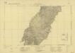
Isola di Scarpanto, M. Cimara
Sheet 3 of the six-sheet series: Isola di Scarpanto. Istituto Geografico Militare. Rilievo del 1933. G.S.G.S. 4102. [London] : [War Office]
![Rhodus Ins. [Karte], in: Gerardi Mercatoris Atlas, sive, Cosmographicae meditationes de fabrica mundi et fabricati figura, S. 523.](https://images-2.georeferencer.com/images/iiif/579346094983/full/,300/0/native.jpg)

