Maps of Bayern
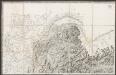
Theatre De La Guerre En Baviere &c: Le Cercle de Franconie. [Karte], in: Atlas nouveau, contenant toutes les parties du monde [...], Bd. 1, S. 267.
1 Karte aus Atlas Sanson, Nicolas Jaillot, Alexis Hubert und Mortier, Pieter
Karte vom Königreich Baiern
1 : 1100000 Bavorsko (Německo) in A.G. Schneider u. Weigels k. priv. Kunst- u. Landkartenhandlung
Königreich Bayern
1 : 1284000 Bavorsko (Německo) Tranquillo Mollo
Chur-Bayern im Jahr 1802
1 Karte : Kupferdruck ; 39 x 43 cm Rheinwald; Herdegen; Leizel s.n.
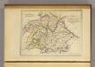
Königreich Baiern nach der neuesten Begrenzung
1 : 700000 Bavorsko (Německo) Mollo, Tranquillo T. Mollo
Königreich Baiern nach der neuesten Begrenzung
1 : 700000 Bavorsko (Německo) Mollo, Tranquillo T. Mollo
Das Königreich Bayern
1 : 860000 Bavorsko (Německo) Weiland, Karl Ferdinand Gräf, A. Geographisches Institut
Composite: Bayern.
1 : 650000 Radefeld, Carl Christian Franz, 1788-1874
Theatre de la Guerre en Baviere &c.
1 : 570000 Mollova mapová sbírka Mortier, Pieter Covens, Johannes I
Southern Germany.
1 : 1710720 Fullarton, A. & Co.
SW Deutschland.
1 : 4100000 Brudin, J. L.; Stieler, Adolf
Königreich Bayern
1 : 1240000 Bavorsko (Německo) Mollo, Tranquillo bey Tranquillo Mollo
[Koenigreich Baiern, Würtemberg u. Baden]
Neuester Schul-Atlas Walch, Johann im Verlag bei Joh. Walch
Geschäfts-Uebersichtskarte des Steuer-Katasters bis zum Schlusse des Jahres 18..
1 : 800000 K. Stiglmayer Contur gravirt J. Obernetter Schrift gravirt [S.l.] : [s.n.]
Das Königreich Baiern
1 : 780000 Bavorsko (Německo) Dirwald, Joseph Mannert, Conrad T. Mollo
Chur-Bayern im Jahr 1804
1 : 1083000 Bavorsko (Německo) Herdegen, J. C. F. Leizel, Balthasar Friedrich J.L.C. Rheinwald
La Baviere, le Wurtemberg, et le Gr. Duche de Bade
1 : 2000000 Malte-Brun, Conrad, 1775-1826
Königreich Bayern Kreisunmittelbare Städte 1862
Bayern Kreisfreie Stadt Kunz, Andreas ; Johnen, Bettina ; Moeschl, Joachim
CHARTE vom KÖNIGREICHE BAYERN
Bavorsko (Německo)
Charte vom Königreiche Bayern
Bavorsko (Německo)
Das Konigreich Bayern
1 : 850000 Weiland, C.F.
Neueste Karte von Bayern Würtemberg, Baden und Hohenzollern
Grosser Hand-Atlas über alle Theile der Erde in 170 Karten Meyer, J. Verlag des Bibliographischen Instituts
Königreich Bayern Bezirksämter 1862
Bayern Bezirksamt Kunz, Andreas ; Johnen, Bettina ; Moeschl, Joachim
Germany No. 3.
1 : 1500000 Colton, G.W.
Germany.
1 : 1500000 Colton, G.W.
Germany.
1 : 1500000 Colton, G.W.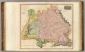
Germany S. of Mayne.
1 : 860000 Thomson, John
Bayern.
1 : 1390000 Flemming, Carl
![Theatre De La Guerre En Baviere &c: Le Cercle de Franconie. [Karte], in: Atlas nouveau, contenant toutes les parties du monde [...], Bd. 1, S. 267.](https://images-2.georeferencer.com/images/iiif/125617055712/full/,300/0/native.jpg)

