Maps of Germany

Téatre De La Guerre Des Couronnes du Nord. [Karte], in: Atlas nouveau, contenant toutes les parties du monde [...], Bd. 1, S. 67.
1 Karte aus Atlas Sanson, Nicolas Jaillot, Alexis Hubert und Mortier, Pieter
[Einwanderung in Reval 1710-1786)
Reval Einwanderung Gebauer, Victor
Porostní mapa revíru Srbice
1 : 2880
Western Europe. Pergamon World Atlas.
1 : 5000000 Polish Army Topography Service
Map of the Post-Route to & from St. Petersburgh
1 : 24000000 Osteuropa Deutschland Polen Russland Reiseweg Postroute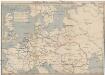
Schiffbare Wasserstrassen in Mitteleuropa
1 : 15000 Evropa střední Oelwein, A.
[Einwanderung in Reval 1639-1710)
Reval Einwanderung Essen, Nicolai v. ; Eichhorn, Nicolai
Carte des états slaves rendus indépendants par Samo, et groupés autour de lui (an 625 à 650), en face du royaume réduit des Avars, enserré à l’est par les Khazars et les Bulgares, et au sud et à l’ouest par les Slaves que l’empereur Héraclius avait établis au sud du Danube
Ostmitteleuropa Tschechische Republik Slawen Awaren Samo
Tabula Europae IIII. [Karte], in: Geographia universalis vetus et nova complectens Claudii Ptolemaei Alexandrini enarrationis libros VIII, S. 231.
1 Karte aus Atlas Münster, Sebastian [und Ptolemaeus, Claudius]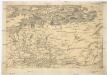
[Centralis Europae]
Evropa střední Schedel, Hartmann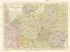
Střední Evropa
1 : 3000000 Evropa střední Kuchař, Karel Janka, Jaromír V. Neubert a synové
Conspectus Generalis omnium earum partium quae unquam ad Imperium Francicum vel Franco-Romanum demum Romano-Germanicum diversis temporum periodis pertinuerunt.
1 : 11000000 Mollova mapová sbírka Homann, Johann Baptist Homann, Johann Baptista - dědici
Quarta Europe Tabula [Karte], in: [Clavdii Ptholomei Cosmographi ...], S. 260.
1 Karte aus Atlas Nicolaus Germanus [und Ptolemaeus, Claudius]
Tabula Europae IIII. [Karte], in: Claud. Ptolemaeus. Geographia lat. cum mappis [...], S. 263.
1 Karte aus Atlas Münster, Sebastian [und Ptolemaeus, Claudius]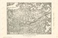
Die Ältesten Karten von Deutschland

Die grossen Friedensschlüsse II (1735 - 1812). Frankreichs, Rußlands und Englands Vorschreiten 1801-1812
1 : 20000000 Mitteleuropa, Osteuropa, Napoleonische Kriege
Part of North of Europe.
1 : 3800000 Melish, John
Quarta Europae Tabula. [Magna Germania] [Karte], in: Claudii Ptolemei viri Alexandrini mathematice discipline philosophi doctissimi geographie opus [...], S. 160.
1 Karte aus Atlas Waldseemüller, Martin [und Ptolemaeus, Claudius] Übelin, Georg
Polen, Litthauen und das Gebiet des deutsche Ordens in den Jahren 1386 - 1480
1 : 6000000 Polen-Litauen, Preußen (Ordensstaat)
Nord- und Ostseeherrschaft III
1 : 10000000 Ostseeraum, Deutscher Orden, Deutsche Hanse
Übersichtskarte der Verbreitung der Deutschen in Europa
Evropa Kiepert, Heinrich Haas, František Dietrich Reimer
Große Sprachenkarte von Mitteleuropa
1 : 2000000 Lange, Friedrich Reimer
Mitteleuropa
1 : 3000000 Evropa střední Kartogr. Anstalt G. Freytag & Berndt
Nord- und Ostseeherrschaft I: Reich Knuts des Großen
1 : 12000000 Nordeuropa Knud II., Danmark, Konge
Das neue politische Gesicht Mitteleuropas
1 : 2000000 Evropa střední Velhagen & Klafing
Das neue politische Gesicht Mitteleuropas
1 : 2000000 Evropa střední Velhagen & Klafing
Das neue politische Gesicht Mitteleuropas
1 : 2000000 Evropa střední Velhagen & Klafing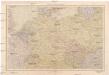
Střední Evropa
1 : 4500000 Evropa střední V. Neubert a synové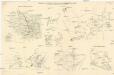
Skizzen zu den größeren Manövern der fremden Armeen 1906
Francie Streffleur, Valentin Ritter von L. W. Seidel & Sohn
![Téatre De La Guerre Des Couronnes du Nord. [Karte], in: Atlas nouveau, contenant toutes les parties du monde [...], Bd. 1, S. 67.](https://images-0.georeferencer.com/images/iiif/816776087970/full/,300/0/native.jpg)

