Maps of Penobscot County

Springfield
1 : 62500
Springfield
1 : 62500
Springfield
1 : 62500
Springfield
1 : 62500
Springfield
1 : 62500
Springfield
1 : 62500
Springfield
1 : 48000
Springfield
1 : 62500
Springfield
1 : 62500
Weir Pond
1 : 24000
Bottle Lake
1 : 24000
Bottle Lake
1 : 24000
Springfield SW
1 : 24000
Springfield SE
1 : 24000
Bowers Mountain
1 : 24000
Springfield NW
1 : 24000
Lincoln
1 : 100000
Lincoln
1 : 100000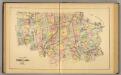
Timber lands 3.
1 : 253440 J.H. Stuart & Co.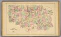
Timber lands 3.
1 : 253440 George N. Colby & Co.
Millinocket
1 : 250000
Millinocket
1 : 250000
Millinocket
1 : 250000
Millinocket
1 : 250000
Millinocket
1 : 250000
Millinocket
1 : 250000
Millinocket
1 : 250000
Topographical map of the county of Penobscot Maine
1 : 80000 Walling, Henry Francis, 1825-1888 Lee & Marsh
Penobscot Co., Maine.
1 : 310000 George N. Colby & Co.

