Maps of Andalucía
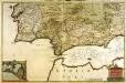
Regnorum Castellæ novæ Andalusiæ Granadæ Valentiæ et Murciæ accurata tabula
1 Karte auf 2 Blatt : Kupferdruck ; 52 x 81 cm Visscher Nicolaes Visscher
Regnorum Castellae Veteris, Legionis et Gallaeciae principatuumq(ue), Biscaiae et Asturiarum accuratissima descriptio
1 : 250000 [by Cornelis Danckertsz] [Amsterdam] : per Nicolaum Visser Amst. Bat.
Regnum Castellæ novæ, Andalusiæ, Granadæ, et Algarbiæ, nec non maxime partis Portugalliæ, et Extremaduræ
1 Karte : Kupferdruck ; 45 x 55 cm Danckerts Justus Danckerts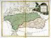
Andalusia et Granada
1 Karte : Kupferdruck ; 28 x 38 cm Zatta presso Antonio Zatta
Spanien, Portugal SW.
1 : 1800000 Berghaus, Heinrich; Flemming, Carl; Sohr, Karl; Theinert, A.

[Spanien und Portugal, Blatt 3]
Adolf Stieler's Handatlas über alle Theile der Erde und über das Weltgebäude Stieler, Adolf Justus Perthes
A new Military Map of Spain and Portugal compiled from The Nautical Surveys of Don Vincent Tofiño, the new Provincial maps of Don Tomas Lopez, the large map of the Ptrenees by Roussill, and various original documents
1 Mapa en 4 seccions dins d'un estoig. John Stockdale J. Stockdale
Perfectissima geographica delineatio Regnorum Vandalitiae, Granatae, et Algarbiae; tractuum, Meridionalium Portugalliae Extremadurae ac Castellae Novae
1 : 1100000 summâ diligentià correcta et edita a R. & I. Ottens Amst. Batavo. Amst. R. & I. Ottens
Spain = España : III
1 mapa. J. & C. Walker sculp The Society for the Diffusion of Useful Knowledge; Baldwin & Gradock
Les estats de la couronne de Castille, dans les parties plus meridionales de l'Espagne
1 Karte : Kupferdruck ; 40 x 53 cm Sanson; Mariette; Somer chez Pierre Mariette rue S. Iacques a l'esperance
[Spanien und Portugal in 4 Blättern]
Hand-Atlas über alle Theile der Erde und über das Weltgebäude Stieler, Adolf Justus Perthes
[Spanien und Portugal in 4 Blättern]
Hand-Atlas über alle Theile der Erde nach dem neuesten Zustande und über das Weltgebäude Stieler, Adolf bei Justus Perthes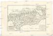
L'Andalousie avec les royaumes de Grenade et de Murcie
1 : 7660000 Andalusie (Španělsko) Bonne, Rigobert André
[9][9] Regnorum Castellae Novae, Andalusiae, Granadae Valentiae, et Murciae..., uit: Atlas sive Descriptio terrarum orbis
Annotatie: Gedigitaliseerde versie. Amsterdam. Heiloo : Picturae (vervaardiger), 2015. tiff-bestand. Gedigitaliseerd: 07-01-2015; Origineel: Universiteitsbibliotheek Vrije Universiteit (XL.05127.-) ; Netherlands; Titelpagina ontbreekt Wit, Frederik de Amsterdam : Frederick de Wit
Partie, l'Espagne, Portugal. Europe 24.
1 : 1641836 Vandermaelen, Philippe, 1795-1869
Partie meridionale des etats de Castille
1 Karte : Kupferdruck ; 46 x 53 cm Robert de Vaugondy; Santini; Remondini chez M. Remondini
Partie meridionale des etats de Castille
1 Karte : Kupferdruck ; 47 x 54 cm Robert de Vaugondy G. et D. Robert de Vaugondy
Les frontieres d'Espagne et de Portugal
1 Karte : Kupferdruck ; 57 x 42 cm Fer; Starckman chez l'auteur dans l'isle du Palais sur le quay de l'orloge a la sphere royale
Regnorum Castellae novae, Andalusiae, Granadae Valentiae, et Murciae accurata tabula
1 : 1400000 in episcopatus etc. divisa et edita per Fredericum de Wit Amstelodami : ex officina P. Mortier
Regnorum Castellæ novæ, Andalusiæ, Granadæ Valentiæ, et Murciæ accurata tabula, in episcopatus etc. divisa
1 Karte : Kupferdruck ; 48 x 58 cm Wit ex officina I. Cóvens et C. Mortier
Regnorum Castellæ novæ, Andalusiæ, Granadæ Valentiæ, et Murciæ accurata tabula, in episcopatus etc. divisa
1 Karte : Kupferdruck ; 48 x 58 cm Wit Frederick de Wit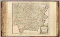
Castille meridionale.
1 : 1320000 Robert de Vaugondy, Gilles, 1688-1766
Carte nouvelle de la partie meridionale du royaume de Portugal et des Algarves
1 Blatt : 46 x 59 cm Covens et Mortier
Espagne et Portugal. Flle. S.O.
1 : 1250000 Vivien St Martin, L.
[Spanien und Portugal in 4 Blättern, Blatt 3]
Handatlas über alle Theile der Erde und über das Weltgebäude Stieler, Adolf Justus Perthes
Regna Hispaniarum, atque Portugalliæ, 3
1 Blatt : 53 x 63 cm Gerard Valck
Spanien Und Portugal In 4 Blattern. Blatt 3.
1 : 1500000 Vogel, C.
Regnorum Castellæ veteris Legionis et Gallæciæ principatuumque Biscaiæ et Asturiarum accuratissima descriptio, 5
1 Blatt : 54 x 41 cm Visscher


