Maps of Pardubice

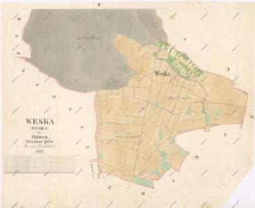
Indikační skica mapy stabilního katastru pro obec Veská II.
1 : 2880
Weska - c8520-1-001 - Kaiserpflichtexemplar der Landkarten des stabilen Katasters
1 : 2880
Weska - c8520-1-002 - Kaiserpflichtexemplar der Landkarten des stabilen Katasters
1 : 2880
Mýtební mapa revíru Veská
1 : 2880
Porostní mapa revíru Koloděje Sekce I.
1 : 2880
Mapa probírek a čistících sečí hájemství Koloděje
1 : 5000
Mapa hrabání lesního steliva v hájemství Koloděje
1 : 5000
Hospodářská mapa revíru Koloděje
1 : 2880
Hospodářská mapa revíru Koloděje
1 : 2880
Porostní mapa revír Hůrka a Koloděje
1 : 10000
Porostní mapa revíru Koloděje
1 : 10000
Indikační skica mapy stabilního katastru pro město Pardubice V., X.
1 : 2880
Indikační skica mapy stabilního katastru pro obec Velké Koloděje IV.
1 : 2880
Hospodářská mapa Bělobranské dubiny
1 : 2880
Mapa lesů města Pardubice nacházejících se mezi Spojilem, Kolodějemi, Sezemicemi a Počáply, tzv. Bělobranská dubina (koncept)
1 : 2529
Laan (Lany) - c3805-1-002 - Kaiserpflichtexemplar der Landkarten des stabilen Katasters
1 : 2880
Laan (Lany) - c3805-1-003 - Kaiserpflichtexemplar der Landkarten des stabilen Katasters
1 : 2880
Laan (Lany) - c3805-1-001 - Kaiserpflichtexemplar der Landkarten des stabilen Katasters
1 : 2880
Spogil - c7177-1-002 - Kaiserpflichtexemplar der Landkarten des stabilen Katasters
1 : 2880
Spogil - c7177-1-001 - Kaiserpflichtexemplar der Landkarten des stabilen Katasters
1 : 2880
Zminy - c9291-1-002 - Kaiserpflichtexemplar der Landkarten des stabilen Katasters
1 : 2880
Zminy - c9291-1-003 - Kaiserpflichtexemplar der Landkarten des stabilen Katasters
1 : 2880
Zminy - c9291-1-001 - Kaiserpflichtexemplar der Landkarten des stabilen Katasters
1 : 2880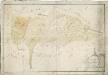
Mapa obecních lesů revíru Koloděje
1 : 2591
Porostní mapa Bělobranského hájenství
1 : 2882
Indikační skica mapy stabilního katastru pro město Pardubice V., X., XIV., XV
1 : 2880
Indikační skica mapy stabilního katastru pro obec Veská I.
1 : 2880
Waldbestandskarte des zur kais. könig. Kameralherrschaft Pardubitz gehörigen Mietitzer Reviers
1 : 3000 Pardubice-oblast (Česko) Jiřička, Josef
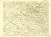
III. vojenské mapování 3956/3
1 : 25000