Maps of Ahaus

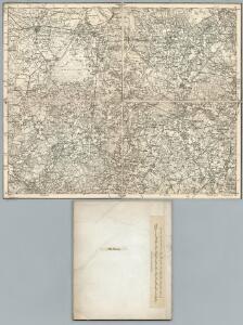
305. Ahaus.
1 : 100000 Reichsamt fur Landesaufnahme
Composite: 305. Ahaus.
1 : 100000 Reichsamt fur Landesaufnahme
35 Ahaus, uit: Topographische en militaire kaart van het Koningrijk der Nederlanden / vervaardigd door de officieren van den Generale Staf ; en gegraveerd op het Topographisch Bureau, van het Ministerie van Oorlog
1 : 50000 titelvariant: TMK; Annotatie: Met bladwijzer op schaal 1:600.000. - 1915; Met Verklaring van de topographische en militaire kaart van het Koninkrijk der Nederlanden. - 1910; Bd. 1: titelblad, bladwijzer, verklaring, bladen 1 t/m 32; Bd. 2: bladen 33 t/m 62 Generale Staf, Nederland; Ministerie van Oorlog. Topographisch Bureau ['s-Gravenhage : Ministerie van Oorlog]
[Kaart], Behoort bij het ontwerp van wet tot ontginning van steenzout bij Buursse (gem. Haaksbergen) / Topographische Inrichting
1 : 25000 titelvariant: Bijlagen van het verslag der handelingen van de Tweede Kamer der Staten-Generaal; Annotatie: Bijlage bij: Bijlagen van het verslag der handelingen van de Tweede Kamer der Staten-Generaal, zitting 1916-1917, nr. 376; Annotatie geografische gegevens: Ondergrond: Chromo-topographische kaart 1:25.000 Topographische Inrichting ['s-Gravenhage : Topographische Inrichting]
[Kaart], Behoort bij het ontwerp van wet tot ontginning van steenzout bij Buursse / Topographische Inrichting
1 : 25000 titelvariant: Bijlagen van het verslag der handelingen van de Tweede Kamer der Staten-Generaal; Annotatie: Bijlage bij: Bijlagen van het verslag der handelingen van de Tweede Kamer der Staten-Generaal, zitting 1917-1918, nr. 328; Annotatie geografische gegevens: Ondergrond: Chromo-topographische kaart 1:25.000 Topographische Inrichting ['s-Gravenhage : Topographische Inrichting]
Germany 1:25,000, Alstatte
Germany 1:25,000 , Series GSGS 4414. Great Britain. War Office. [London] : War Office
Meßtischblatt 2141 : Horstmar, 1935
1 : 250000 Horstmar. - Hrsg. 1897, einz. Nachtr. 1926. - 1:25000. - [Berlin]: Reichsamt für Landesaufnahme, 1935. - 1 Kt.
Meßtischblatt 2141 : Horstmar, 1897
1 : 250000 Horstmar. - Aufn. 1895. - 1:25000. - [Berlin]: Reichsamt für Landesaufnahme, 1897. - 1 Kt.
Meßtischblatt 2140 : Ahaus, 1926
1 : 250000 Ahaus. - Aufn. 1895, einz. Nachtr. 1926. - 1:25000. - [Berlin]: Reichsamt für Landesaufnahme, 1926. - 1 Kt.
Meßtischblatt 2140 : Ahaus, 1897
1 : 250000 Ahaus. - Aufn. 1895. - 1:25000. - [Berlin]: Reichsamt für Landesaufnahme, 1897. - 1 Kt.
Meßtischblatt 2139 : Ottenstein in Westfalen, 1914
1 : 250000 Ottenstein in Westfalen. - Aufn. 1895, hrsg. 1897, Aufl.- dr. 1914. - 1:25000. - [Berlin]: Reichsamt für Landesaufnahme, 1914. - 1 Kt.
Meßtischblatt 2074 : Metelen, 1897
1 : 250000 Metelen. - Aufn. 1895. - 1:25000. - [Berlin]: Reichsamt für Landesaufnahme, 1897. - 1 Kt.
Meßtischblatt 2073 : Nienborg, 1903
1 : 250000 Nienborg. - Aufn. 1895, hrsg. 1897, einz. Nachtr. 1903. - 1:25000. - [Berlin]: Reichsamt für Landesaufnahme, 1903. - 1 Kt.
Meßtischblatt 3807, Preuß. 2072 alt : Alstätte, 1939
1 : 250000 Alstätte. - Aufn. 1895, hrsg. 1897, bericht. 1939. - 1:25000. - [Berlin]: Reichsamt für Landesaufnahme, 1939. - 1 Kt.
Meßtischblatt 3707 : Glanerbrücke, 1949
1 : 250000 Glanerbrücke. - Aufn. 1895, hrsg. 1896, bericht. 1939. - 1:25000. - [Berlin]: Reichsamt für Landesaufnahme, 1949. - 1 Kt.
Meßtischblatt 2004 : Glanerbrücke, 1896
1 : 250000 Glanerbrücke. - Aufn. 1895. - 1:25000. - [Berlin]: Reichsamt für Landesaufnahme, 1896. - 1 Kt.
Meßtischblatt 2005 : Gronau in Westfalen, 1925
1 : 250000 Gronau in Westfalen. - Aufn. 1895, einz. Nachtr. 1925. - 1:25000. - [Berlin]: Reichsamt für Landesaufnahme, 1925. - 1 Kt.
Meßtischblatt 2005 : Gronau in Westfalen, 1897
1 : 250000 Gronau in Westfalen. - Aufn. 1895. - 1:25000. - [Berlin]: Reichsamt für Landesaufnahme, 1897. - 1 Kt.
Meßtischblatt 2006 : Ochtrup, 1934
1 : 250000 Ochtrup. - Hrsg. 1897, einz. Nachtr. 1925, gedr. [19]34. - 1:25000. - [Berlin]: Reichsamt für Landesaufnahme, 1934. - 1 Kt.
Meßtischblatt 2006 : Ochtrup, 1897
1 : 250000 Ochtrup. - Aufn. 1895. - 1:25000. - [Berlin]: Reichsamt für Landesaufnahme, 1897. - 1 Kt.
Germany 1:25,000, Gronau
Germany 1:25,000 , Series GSGS 4414. Great Britain. War Office. [London] : War Office
Germany 25.000, Gronau
Sheet 3708 from the map series: Germany 1 : 25,000. AMS M 841. (GSGS. 4414). [Washington, D.C.] : Army Map Service
Germany 1:25,000, Ochtrup
Germany 1:25,000 , Series GSGS 4414. Great Britain. War Office. [London] : War Office
Germany 1:25,000, Enschede
Germany 1:25,000 , Series GSGS 4414. Great Britain. War Office. [London] : War Office
COMITATVS | BENTHEIM, | et | STEINFVRT.
Auctore | Ioanne Westenberg | M. Doct. et Math. Guljelm. Blaeu excudebat
16me Oldenzaal, uit: [Nouvelle carte de la Hollande, d'après Kraijenhoff et les meilleures cartes connus] / [Ph. Vandermaelen]
1 : 130000 Annotatie: Ontbreekt: bl. 1-12 Vandermaelen, Philippe Marie Guillaume Bruxelles : Établissement Géographique
Comitatus Bentheim, et Steinfurt. [Karte], in: Theatrum orbis terrarum, sive, Atlas novus, Bd. 1, S. 212.
1 Karte aus Atlas Blaeu, Joan Blaeu, Willem Janszoon
Comitatus Bentheim, et Steinfurt. [Karte], in: Novus Atlas, das ist, Weltbeschreibung, Bd. 1, S. 132.
1 Karte aus Atlas Blaeu, Joan Blaeu, Willem Janszoon
Comitatus Bentheim, et Steinfurt. [Karte], in: Novus atlas absolutissimus, Bd. 2, S. 121.
1 Karte aus Atlas Janssonius Offizin